
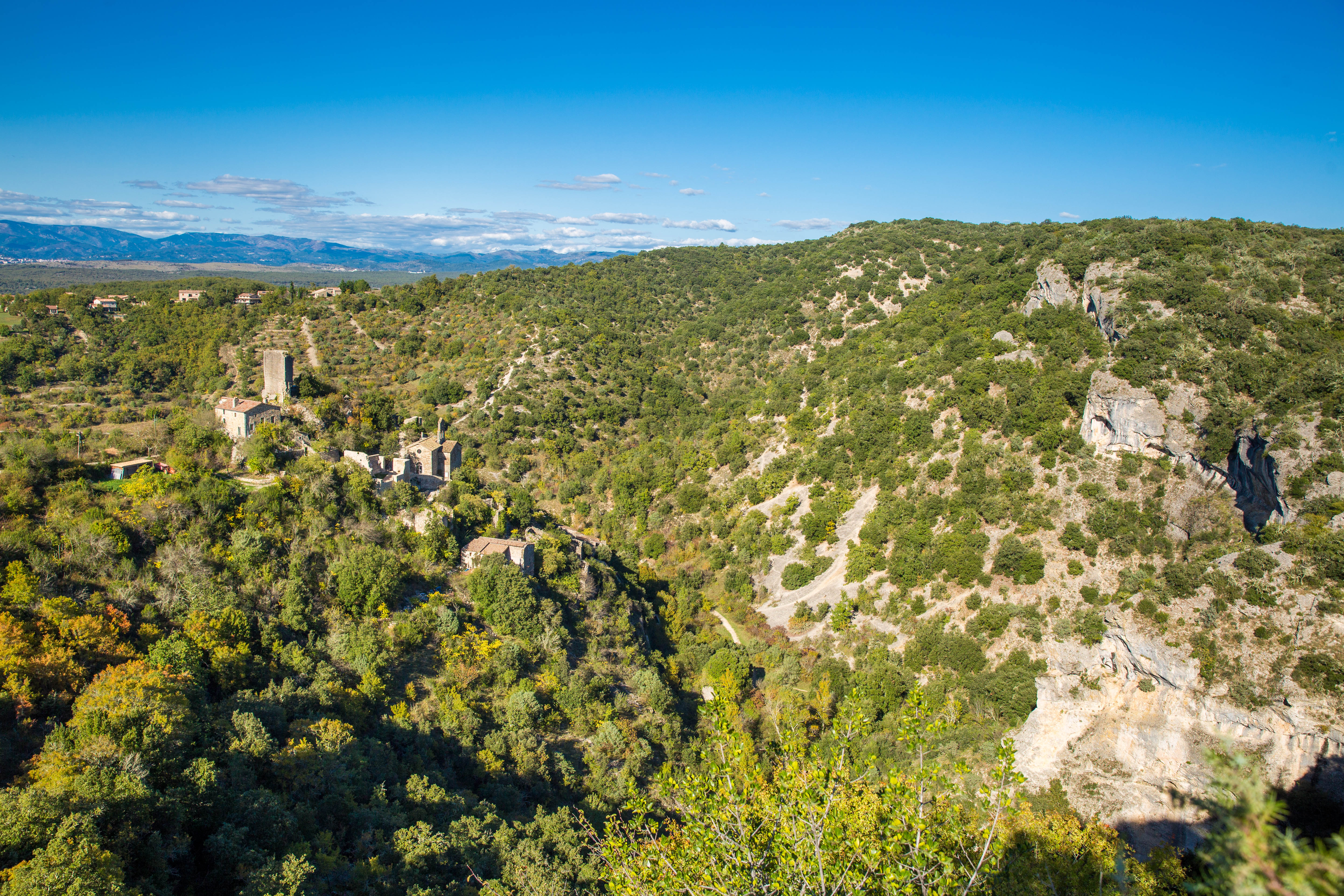
The walk around Rochecolombe and its waterfall
Much of the route consists of rocky paths, some of which are steep in places.
This walk begins on a fairly steep ridge path, continues along an easier balcony path, and then descends a rocky slope. You then stroll through the old village before finishing at the foot of the waterfall, which doesn’t flow very often but is still a beautiful spot.
Description
Head to the far end of the car park, take the path to the left and do not cross the river. Walk uphill past a small barn. Then follow the  marks; continue uphill along this ridge path for approximately 800 metres. This path offers some lovely views of the old village.
- At the “Lauzière” signpost (50 m before you come out onto a wide track), take the path running along the ridge to the right, signposted “Les Baux (Belvédère) 0.6 km”.
- When it joins a wide track at the “Les Baux” signpost, take the path that veers off to the right into the woodland for a return trip to the viewpoint. Back at the signpost, take the path that runs alongside a low wall to the right towards “Ron Chamorel – Rochecolombe”. Then take the fork leading to the left. The path eventually zigzags and descends steeply. After crossing the stream – which is almost always dry – head back up to the right.
- At the next junction (at the “Ron Chamorel” signpost), continue to the right towards “Rochecolombe 1.3 km”. When the path joins a small road, follow it down to the right for just over 100 metres.
- Before the ‘Ancien Village’ signpost, leave the marked path and turn right to head down into the narrow streets of the old village. Keep turning right until you reach the ‘Chemin de la cascade’. Follow this path, cross the small bridge and walk upstream along the stream to the foot of the waterfall (which is not the source of the water supply). Then retrace your steps, staying on the right bank of the stream until you reach the next bridge. Cross it, then turn right and cross the stream again. Then head back up to the left until you reach the car park.
- Departure : Car park beneath the old village (Route de la Figeyrolle)
- Arrival : Car park beneath the old village
- Towns crossed : ROCHECOLOMBE
Forecast
Altimetric profile
Information desks

Office de Tourisme Gorges de l'Ardèche - Ruoms
9 rue Alphonse Daudet, 07120 Ruoms
Office de Tourisme Gorges de l'Ardèche - Vogüé
52 Rue Grande Rue, 07200 Vogüé
Access and parking
From the D1 between Vogüé and Lagorce, take the D401 towards Rochecolombe. When you reach the village square, take the road that goes uphill to the left. After 200 metres, turn left downhill. The car park is 200 metres further on, on the right.
Parking :
Report a problem or an error
If you have found an error on this page or if you have noticed any problems during your hike, please report them to us here: