
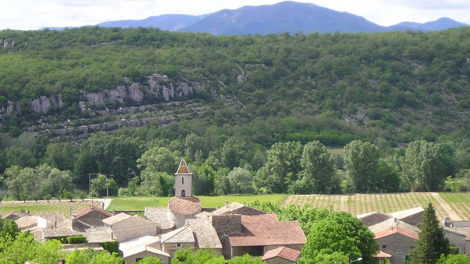
Saint-Maurice-d'Ardèche and its hills
A route with little elevation gain, mainly on wide paths
The Ardèche Valley and landscapes shaped by vineyards and other crops
Description
As you leave the car park, turn left to reach the Info Rando sign.
- Turn right onto ‘Montée de Galine’ and cross over the old railway line. This line between Vogüé and Alès operated from 1876 to 1969 for passengers and until 1988 for freight. Follow the signposts.
- At the “St-Maurice-d’Ardèche” signpost, follow the signs for “Chaussy 2.1 km – Hameau de Leyris 4.4 km”. To do this, head down onto the Via Ardèche (greenway).
- After passing the viaduct, at the ‘Chalouzet’ signpost, turn left off the track and follow the signs for ‘Chaussy 1.3 km – Hameau de Leyris 3.6 km’. Stay on the main path as it climbs. At the first crossroads (at the edge of the woods), turn left and continue straight on.
- After the path turns left and then right, you’ll come to the signpost marked ‘Chaussy’; follow the sign for ‘St-Maurice-d’Ardèche 2.4 km, Rochecolombe 3.5 km’, heading to the left. The path winds down through the vineyards until it joins a
tarmac road. Turn right there. - At the “La Planche” signpost, follow the sign for “St-Maurice-d’Ardèche 1.4 km”: leave the tarmac road and take the path leading uphill to the left. At the next junction, turn left and, a few metres further on, you will come to a tarmac road. At a left-hand bend, take the path opposite which leads down to the signpost
‘St-Maurice-d’Ardèche’. Follow the signs for ‘Info Rando 0.1 km – Lanas 1.1 km’. At the T-junction, turn left to return to the starting point.
- Departure : Place Terlin, 07200 Saint-Maurice-d'Ardèche
- Arrival : Place Terlin, 07200 Saint-Maurice-d'Ardèche
- Towns crossed : SAINT-MAURICE-D'ARDECHE and BALAZUC
Forecast
Altimetric profile
Recommandations
Please respect crops and private property along the route.
Clothing suitable for the weather, water bottle
Information desks

Office de Tourisme Gorges de l'Ardèche - Ruoms
9 rue Alphonse Daudet, 07120 Ruoms
Office de Tourisme Gorges de l'Ardèche - Vogüé
52 Rue Grande Rue, 07200 Vogüé
Transport
Route E15; Avignon/Aubenas. St-Maurice-d’Ardèche stop
Alternatively, Route X76: Valence TGV / Montélimar / Vallon Pont d’Arc. From the Balazuc stop, follow the D579 and take the small road that joins the Via Ardèche, then continue to the ‘Chalouzet’ signpost (point 3 of the step-by-step guide).
Access and parking
From Vogüé: Take the D579 south and turn left just after the turn-off for Lanas. The car park is a little further on, on the right (near the town hall).
From Ruoms: Take the D579 north, turn right at the bakery just as you enter the village of St-Maurice, then take the first street on the left. The car park is 100 metres further on, on the left.
Parking :
Report a problem or an error
If you have found an error on this page or if you have noticed any problems during your hike, please report them to us here: