The Coucouru
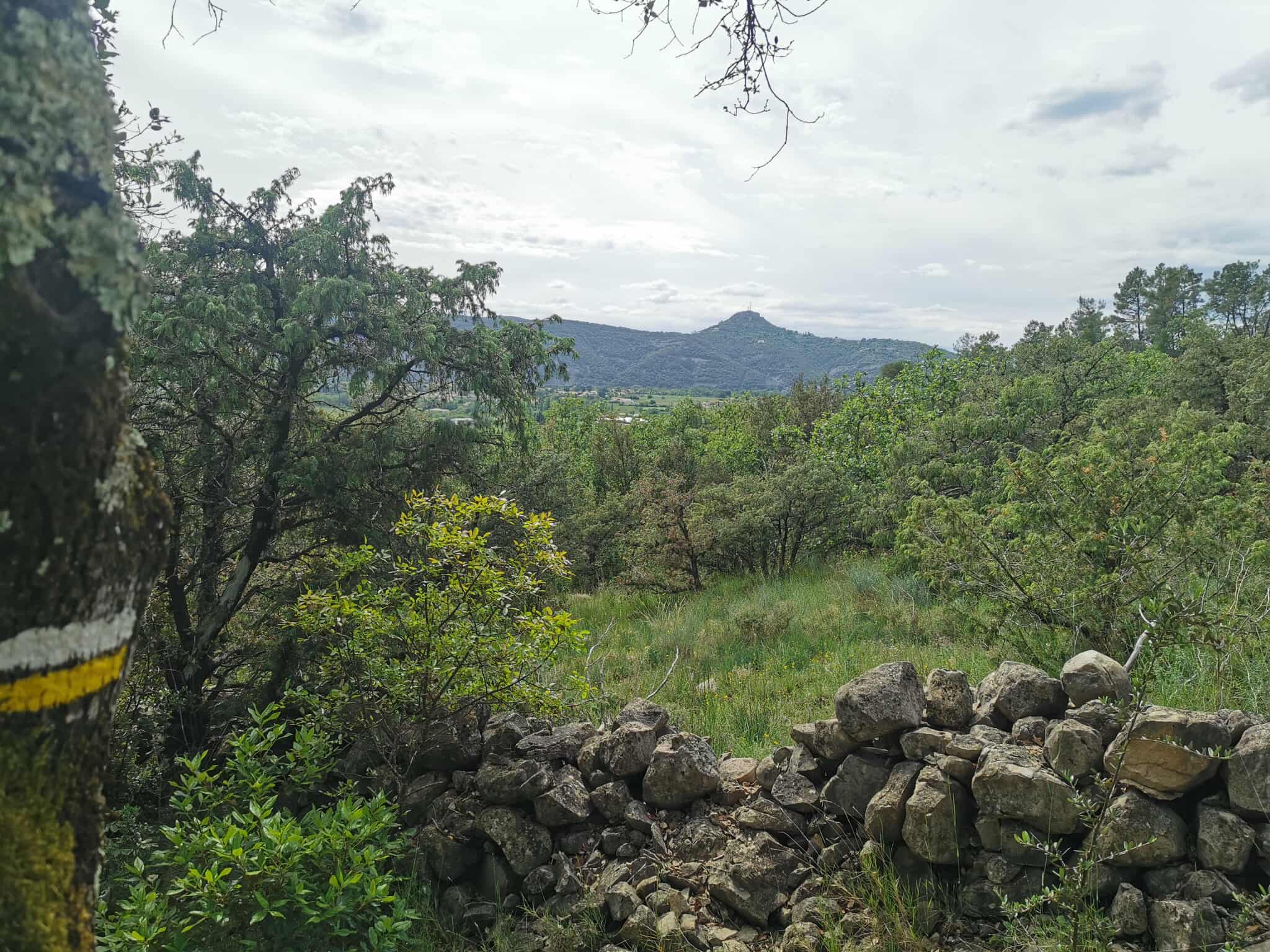
As you move away from the village, the atmosphere becomes more peaceful. Only the sound of your footsteps on the path and the song of the cicadas disturb the calm in summer. The post-season sun, filtered through the evergreen oaks, illuminates the dry stone walls. At the summit of Coucouru, the panorama opens up, revealing the gentle plains of the Ardèche bathed in light. This is a walk that combines the silence of the garrigue with the openness of the great landscapes.
Description
- With your back to the Tourist Office, walk along the pavement in front of you, then turn right towards the Vallon-Pont-d'Arc junction. Follow signs for Coucouru 3.2 km Salavas 2.2 km
- Follow the white and yellow signs up rue Louis Claron and continue towards Coucouru. When you see the hospital on your right, take the street that runs alongside it; turn left and then immediately right into rue des Maquisards. Opposite the temple, turn right. Continue until you reach the Bourdaric junction. follow Coucouru 2.6 km Ruoms 7.8 km
- Just before the cemetery, turn right and follow the Chemin du Fez until you reach the Coulette junction. follow Coucouru 2.3 km
- After 100 m, turn left onto a carriage road. Stay on the track around the hill. Just before the track rises and becomes very stony, turn right onto a path that climbs towards the summit of Coucouru.
- At the Coucouru crossroads, follow signs for Vallon-Pont-d'Arc for 4.4 km. The name Coucouru comes from a very ancient root of Eastern European and pre-Gaulish origin: kuk, meaning "rounded height". Over the centuries it evolved into kok, kouk and couk. The same origin can be found in well-known names such as Coucouron and the Coucoulude rock above Valgorge. In this scrubland of holm oak, boxwood and juniper, the path is bordered in places by low drystone walls, evidence of former agricultural or pastoral use. As you leave the wooded area, you come out facing the Saint Martin plain. Turn left onto a track that offers a remarkable panorama. At the next crossroads, leave the track and take the small path furthest down on the right. This very steep path leads through the woods to the Saint-Martin junction.
- Follow Vallon-Pont-d'Arc 2 km The tarmac road that crosses the Saint Martin plain passes through the Coulette junction. Follow Vallon-Pont-d'Arc 0.6 km Take the same route as before. At the corner of the cemetery, turn left to reach the Le Bourdaric junction. Follow Info Rando Back through the village to the starting point.
- Departure : Tourist Office - Vallon Pont d'Arc
- Arrival : Tourist Office - Vallon Pont d'Arc
- Towns crossed : VALLON-PONT-D'ARC
Forecast
Altimetric profile
Information desks

Office de Tourisme Gorges de l'Ardèche - Vallon-Pont-d'Arc
16 rue des Abeilles, 07150 Vallon Pont d’Arc
Access and parking
From Aubenas, take the D579 towards Vogüé, Gorges de l'Ardèche to Vallon-Pont-d'Arc.
From Bourg-Saint-Andéol, follow the signs to Vallon-Pont-d'Arc.
From Alès, take the D104 towards Aubenas. Then take the D111 towards Gorges de l'Ardèche until Vallon-Pont-d'Arc.
Parking :
Report a problem or an error
If you have found an error on this page or if you have noticed any problems during your hike, please report them to us here: