The Cassoles Trail
A path with a 20% gradient for the first 400 metres, followed by a very rocky section in the second half
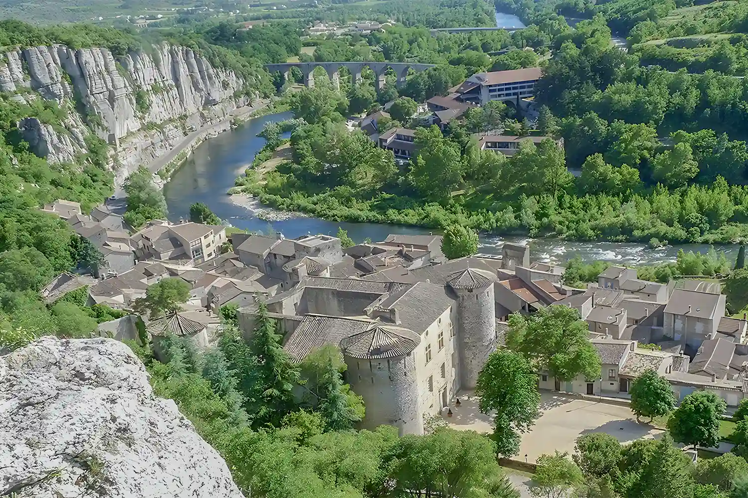
A lovely short walk, mainly through the countryside just outside Vogüé. Stunning views of the village and the clapas (stone walls). Flower-filled scrubland. Rocky woodland.
Description
Departure from the tourist information office.
- Take the main street and turn left at the first street, ‘La Calade’, then follow the yellow and white markings.
- You are on the castle approach road; take the ‘Chemin de la Gleyzette’. Keep to the right towards La Gleyzette.
- Stop at La Chapelle to enjoy the view of the village. Continue along the path at the foot of the building. Head up towards the Giraud quarry. You are welcome to visit the site. Please note that you are entering private property, made available by the Giraud family. We would be grateful if you could respect the site.
- If you have visited the quarry, take the small bridge; otherwise, continue along the dirt track towards ‘La croix de Saint-Cerice’ (marked with white and yellow signs).
- When you reach the cross, continue straight ahead along the path, then turn left onto the ‘Cassoles’ path between the low walls (signposted).
- After about 700 metres along the path, turn left at the wooden post. Follow the ‘Lézard’ signposts.
- At the end of this path, turn left (signposted again).
- After about 500 metres, when the low wall ends, turn right onto the “Ruisseau de Fontenouille” path (follow the frog symbol on the signpost).
- At the end of this path, turn left and walk uphill a little
- At the junction with the rock known as ‘La Pause’, turn right, then left, and follow the ‘Des Tomples’ path (marked with a snail symbol).
- At the end of this path, opposite the ruins, take the path to the left. Head back down to Vogüé via the narrow street known as ‘la Calade’ to complete your walk.
- Departure : Vogüé: Tourist Office, 52 Rue Grande Rue, 07200 Vogüé
- Arrival : Vogüé: Tourist Office, 52 Rue Grande Rue, 07200 Vogüé
- Towns crossed : VOGUE and SAINT-GERMAIN
Forecast
Altimetric profile
Recommandations
Protect yourself from the sun and make sure you drink plenty of fluids.
Sturdy shoes and, if possible, walking poles for the rocky sections and the descent.
Information desks

Office de Tourisme Gorges de l'Ardèche - Vogüé
52 Rue Grande Rue, 07200 Vogüé
Transport
Route X76: Valence TGV / Montélimar / Vallon Pont d’Arc
Route E15: Avignon / Aubenas
Access and parking
From Aubenas: via the D579 then the D579A.
From Montélimar: via the N102 then the D103, followed by the D579 and D579A.
From Vallon-Pont-d'Arc and Ruoms: via the D579 then the D579A.
Parking :
Report a problem or an error
If you have found an error on this page or if you have noticed any problems during your hike, please report them to us here: