The Blue Stone Trail
VOGUE
The Blue Stone Trail
Easy
1h
3,9km
+95m
-95m
Loop
PR
Embed this item to access it offline
This route will take you through part of the village of Vogüé to the old Vogüé quarries.
The quarries have been famous since the Universal Exhibition of 1878, when the Ministry of Public Works published a list of the 21 most famous limestones in France. In this list, Vogüé blue stone came 2nd, with a density of 2,750 kg/m3.
The quarries have been famous since the Universal Exhibition of 1878, when the Ministry of Public Works published a list of the 21 most famous limestones in France. In this list, Vogüé blue stone came 2nd, with a density of 2,750 kg/m3.
Description
- Start from the Tourist Office.
- Cross the Ardèche and turn left towards Lou Capitelle. Go past the holiday centre and under the "Pont biais". Immediately turn right towards the SPA (wellness area) and take the "voie verte" on your right.
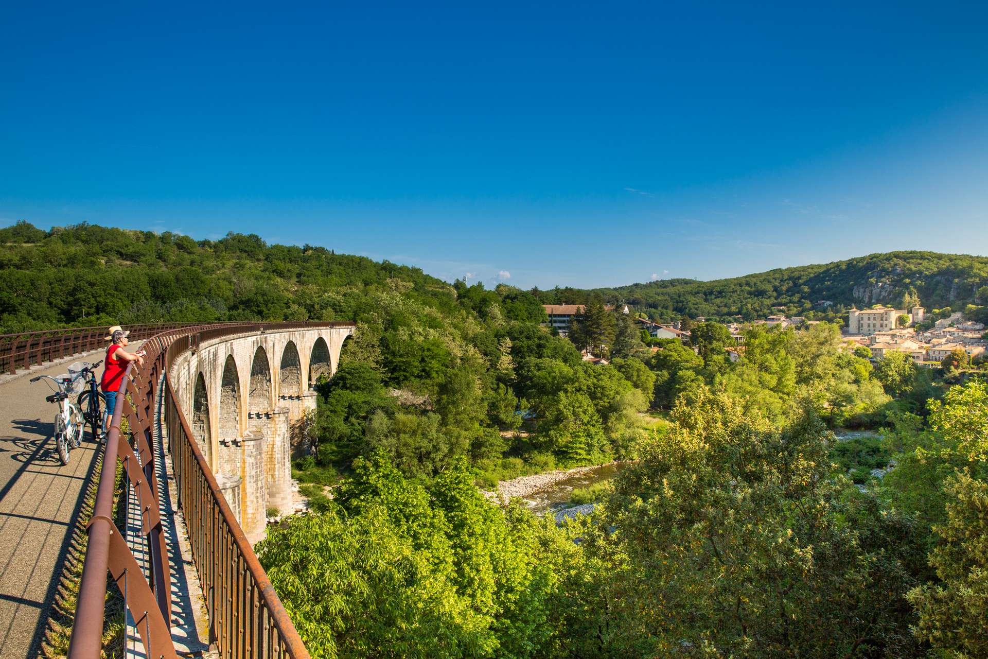
- Cross the Ardèche by the viaduct, which was one of the first bridges built on a curve.
- Before arriving at the "pont de la tranchée", leave the "voie verte" and take the path on the right that runs alongside the campsite.
- When you reach the road, turn left and cross the Pont de la Tranchée. Take the "montée des carriers" road for 700 metres.
- At the end of the tarmac road, turn right and go to the "Croix de Saint-Cerice".
- Turn left at "Traverse de Saint-Cerice" and continue between the low walls. At the end of the traverse, turn left.
- On the way back, you can visit the Giraud quarry, where educational panels explain the work of the quarrymen. Please note that you are entering a private site made available by the Giraud family. Please respect the site.
- After visiting the Giraud quarry, return to the small bridge and head back down to the right towards the village. On the way, admire the gleyzette "Chapelle de Saint-Cerice". Return quietly to the château square.
- Return to the Tourist Office and stroll, if you feel like it, through the narrow streets of the village.
- Departure : Tourist Office - Vogüé
- Arrival : Tourist Office - Vogüé
- Towns crossed : VOGUE
Forecast
Altimetric profile
Recommandations
Protégez-vous du soleil et prenez à boire en suffisance.
Good shoes and possibly walking sticks. Water bottle and hat.
Information desks

Office de Tourisme Gorges de l'Ardèche - Ruoms
9 rue Alphonse Daudet, 07120 Ruoms

Office de Tourisme Gorges de l'Ardèche - Vogüé
52 Rue Grande Rue, 07200 Vogüé
Transport
Ligne X76 : Valence TGV / Montélimar / Vallon Pont d’Arc
Ligne E15 ; Avignon/Aubenas
Ligne E15 ; Avignon/Aubenas
Access and parking
From Aubenas: take the D579 then the D579A. From Montélimar: N102 then D103 then D579 and D579A. From Vallon-Pont-d'Arc and Ruoms: take the D579 then the D579A.
Parking :
Chateau car park, Impasse des Marroniers
Report a problem or an error
If you have found an error on this page or if you have noticed any problems during your hike, please report them to us here: