Through the history and prehistory of St Alban's
SAINT-ALBAN-AURIOLLES
Through the history and prehistory of St Alban's
Medium
4h
11,5km
+194m
-194m
Loop
PR
Not a very difficult route. However, the paths are very stony in places and the limestone slabs can be very slippery.
Embed this item to access it offline
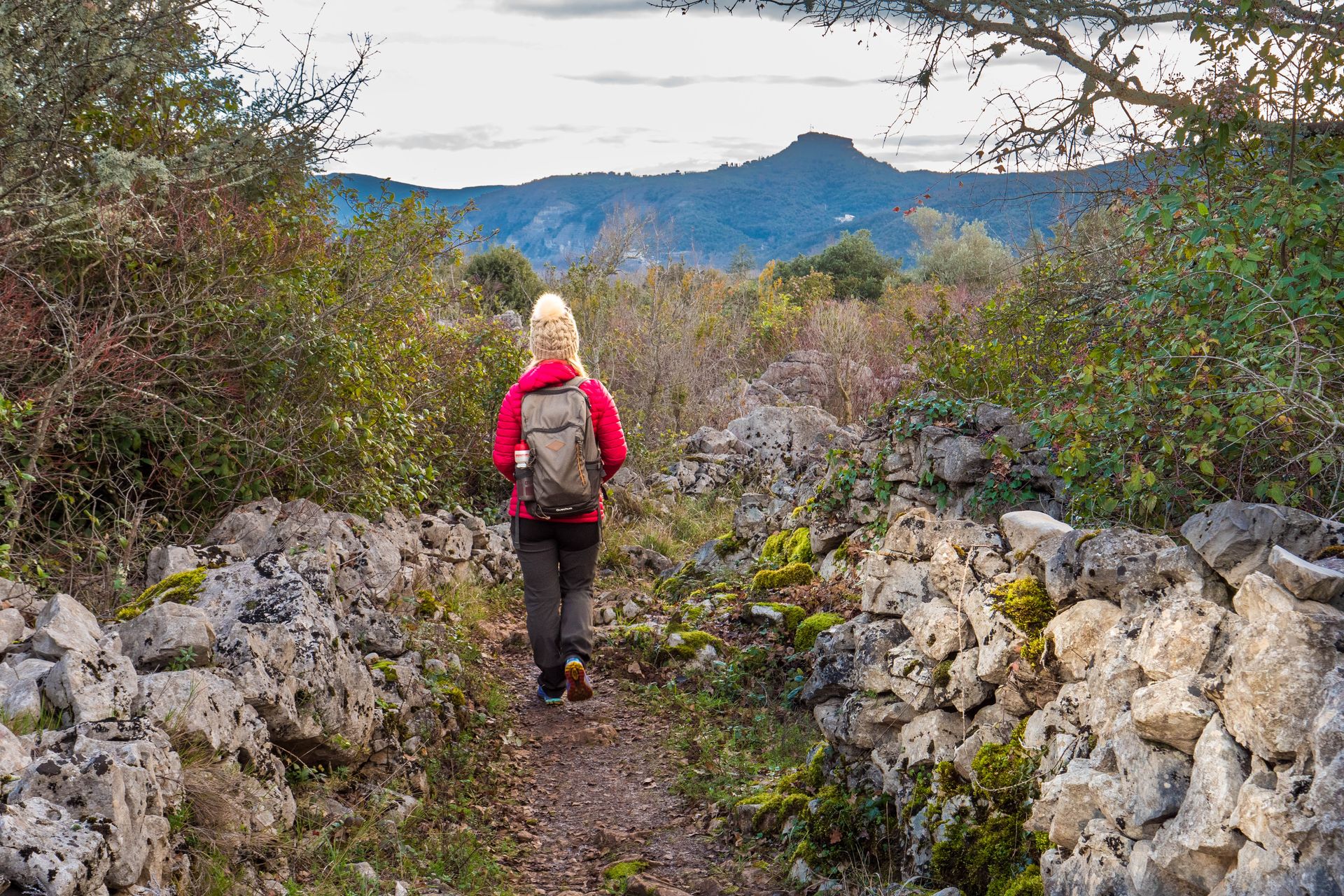
Hiking on trails and paths lined with clapas (dry stone walls), Mediterranean vegetation, limestone rocks and oak trees.
Description
When leaving the car park behind the community hall, turn right. Then take Avenue Pasteur to the right.
- From the Info Rando sign located in the grocery store car park, continue along Avenue Pasteur. Take Rue du Chazal on the right, then left under the trees to reach the church square. Continue straight ahead, then turn right at the T-junction (Rue René Cassin). Take a look at the façade of the old prison, which dates back to 1620. Then take Rue du Grand Champ on the left, then Rue du Château on the right.
- At the hiking signpost for ‘Le Château’, follow ‘Bourbouillet 3.2 km, Chandolas 9.6 km’ to the left. On the way, admire the Château des Beaumefort, built in the 15th century. Go around the surrounding wall, then take the path that climbs towards the Gras limestone plateau.
- At the ‘La Combe du Merle’ signpost, follow ‘Bourbouillet 2.9 km, Chandolas 9.3 km’ to the right. After a little over a kilometre, the path turns right. Leave it and follow the path opposite, which leads to a high wire fence. Continue along the path, going around the fence on the right.
- At the ‘Les Issarts’ signpost, follow: ‘Bourbouillet 0.6 km, Chandolas 7 km’ to the left. Continue to follow the edge of the fence.
- At the ‘L'Espeluche’ signpost, follow: ‘Bourbouillet 0.3 km, Chandolas 6.7 km’ to the left. Continue on a carriage road.
- At the ‘Bourbouillet’ signpost, follow ‘Font Méjane 3 km, Chandolas 6.4 km’ to the left. The road passes in front of the entrance to the Bourbouillet estate. On the climb, leave the road and turn right onto a path blocked by a pasture gate. When passing through, remember to close the gate behind you. The road passes close to a Neolithic necropolis containing around twenty dolmens. Please note that these prehistoric remains are very fragile and must be treated with respect.
- At the ‘Flandrin’ signpost, follow signs for ‘Lablachère’ to the right. The path enters the woods and continues.
- At the ‘Reméjadou’ signpost, follow ‘Bourbouillet 1.2 km, Saint Alban-Auriolles 5.9 km’ to the right. The path passes by the Reméjadou cave. This is a very dangerous chasm, 26 metres deep, with a stream flowing at the bottom. It is reserved for cave divers. It is forbidden to approach it. Continue along the trail, which winds its way through a megalithic chaos similar to that of the Païolive woods. Back at the ‘Bourbouillet’ signpost (6), follow ‘St Alban-Auriolles 3.7 km’ to the left. Below the crossroads, you can visit the Bourbouillet resurgence via a return trail. To continue, follow the fence along the carriage road and pass by the ‘L'Espeluche’ signpost (5). Follow ‘St Alban-Auriolles 3.4 km’ to the right. Back at the signpost: ‘Les Issarts’ (4), follow ‘St Alban-Auriolles 3.1 km’. Take the path lined with low walls on the left.
- At the ‘Ventalon’ signpost, follow: ‘St Alban-Auriolles 3.2 km’, to the right. At the first crossroads, turn right, then at the next one, turn left. Continue along a narrow path lined with low walls. Along the way, you will see a capitelle: a dry stone structure that served as a shelter for shepherds.
- At the ‘Le Dolmen’ signpost, follow ‘le Calvaire 0.3 km’ to the right. After +/- 300 m, take the path on the right for a round trip to the Calvary dolmen. Back on the path, descend to the right for 60 m.
- At the ‘Le Calvaire’ signpost, follow: ‘Cimetière 1.1 km’ to the right. At the next crossroads, turn right and descend to join Rue Montée de la Barnerie. Go downhill to the right and leave the street after approximately 150 m to the left to pass through the hamlet, then take a path along a stream. Continue along the stream via the road.
- At the ‘Cimetière’ signpost, continue along Rue Marius Prebost to return to your starting point.
- Departure : Municipal car park, Saint-Alban-Auriolles
- Arrival : Municipal car park, Saint-Alban-Auriolles
- Towns crossed : SAINT-ALBAN-AURIOLLES and LABLACHÈRE
Forecast
Altimetric profile
Recommandations
The white and yellow markings are missing in many places on this hike, so follow the GPS track and the description carefully.
Good shoes and possibly walking sticks. Water bottle and hat.
Information desks

Office de Tourisme Gorges de l'Ardèche - Ruoms
9 rue Alphonse Daudet, 07120 Ruoms

Office de Tourisme Gorges de l'Ardèche - Vallon-Pont-d'Arc
16 rue des Abeilles, 07150 Vallon Pont d’Arc
Access and parking
From Vallon or Vogüé: take the D579 to Ruoms, then the D4 towards Labeaume, then the D208 to Saint-Alban. The car park is located behind the community hall at 320 Av. Pasteur.
Parking :
Parking behind the community hall at 81 Rue Marius Perbost
Report a problem or an error
If you have found an error on this page or if you have noticed any problems during your hike, please report them to us here: