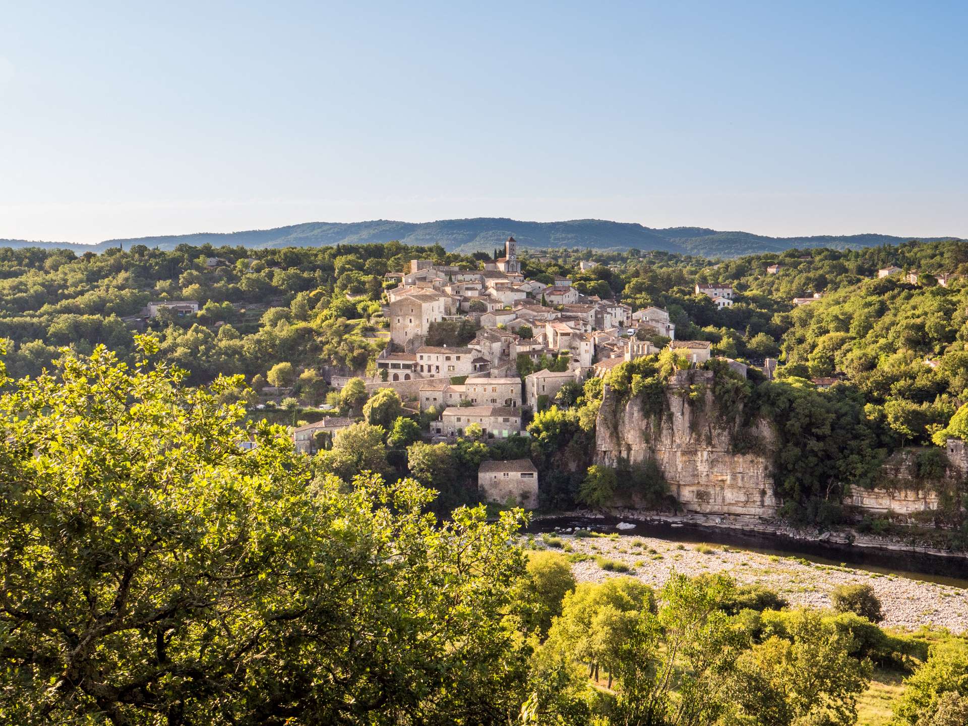
Balazuc and its waterside hamlets
BALAZUC
Balazuc and its waterside hamlets
Medium
2h30
7,8km
+228m
-228m
Loop
PR
The route is very varied, with cobbled streets, an easy path along the Ardèche and then paths with sometimes rocky ascents and descents. A little road with very little traffic.
Embed this item to access it offline
Village and hamlet with old, restored stone buildings. Path along the river. Stone paths in the forest and on the grassy plateau. Garrigue.
Description
From the Info Rando sign at the entrance to the village, walk a short distance down the main road and then uphill to the right. Always follow the signs.
- When you reach the "Portalas" signpost, follow the signs for "Viel Audon 1.6 km" and go down to the left through the narrow streets until you reach the main road. Walk down this street and cross the bridge.
- At the "Le Pont" junction, follow signs for "Chauzon 4.6 km par Viel Audon 1 km". A few metres after the junction, leave the road and take a path on the left along the river. The hamlet of Viel Audon invites you to take a gastronomic break, then take the path that crosses it and climb the hairpin bends to the top of the cliff; further on, at the fork, continue to the right.
- At the "Audon" signpost. Follow "Balazuc 5.5 km", straight on.
- At the "Lubac" sign, follow "Balazuc 5.4 km". Continue on the tarmac road to the right.
- At the "Vigiers" sign, follow "Balazuc 5.1 km". Leave the tarmac track and take a footpath. Join a carriage road and, a few metres further on, turn right onto a footpath. The path crosses a stream, which is mostly dry, before leading to the Balazuc-Uzer road. Turn left for a few metres, then right onto a stony track.
- At the "Tour de la Reine Jeanne" sign. Walk back and forth to the tower and enjoy a superb view of Balazuc. /!\ The Tower is a private site. The owner agrees, in his absence, to share this remarkable place. Please respect the site and its occupants. Then follow the signposted path.
- At the "Chazette" signpost, follow the signs for "Balazuc 3.1 km". After passing a stream, go back up to the left. At the next crossroads, continue along the stony path that runs downhill to the left.
- At the "Les Chabasses" sign, follow "Balazuc 1.7 km" to the right. In the hamlet of Servières, turn right twice and follow the tarmac path to the junction "Le Pont".
- Departure : Balazuc hiking information panel
- Arrival : Balazuc hiking information panel
- Towns crossed : BALAZUC
Forecast
Altimetric profile
Recommandations
To discover Balazuc, download the Baludik app and play the treasure hunt.
Bâtons de marche. Serviettes de bains et maillots.
Information desks

Office de Tourisme Gorges de l'Ardèche - Ruoms
9 rue Alphonse Daudet, 07120 Ruoms

Office de Tourisme Gorges de l'Ardèche - Vallon-Pont-d'Arc
16 rue des Abeilles, 07150 Vallon Pont d’Arc

Office de Tourisme Gorges de l'Ardèche - Vogüé
52 Rue Grande Rue, 07200 Vogüé
Transport
Bus stop Les Plagnes along the D579, 1.5 km from the start of the walk.
Bus route E15 Aubenas - Avignon
Bus route X76 Valence TGV / Montélimar / Vallon Pont d'Arc
Bus route E15 Aubenas - Avignon
Bus route X76 Valence TGV / Montélimar / Vallon Pont d'Arc
Access and parking
From Aubenas: take the D579 towards Vogüé then the D294. From Montélimar: N102 then D103 towards Vogüé then D579 and D294. From Vallon-Pont-d'Arc and Ruoms: take the D579 then the D294.
Parking :
Parkings La Croisette et Champgelly à l'entrée du vieux village; à gauche de la D294
Report a problem or an error
If you have found an error on this page or if you have noticed any problems during your hike, please report them to us here: