Around Bidon
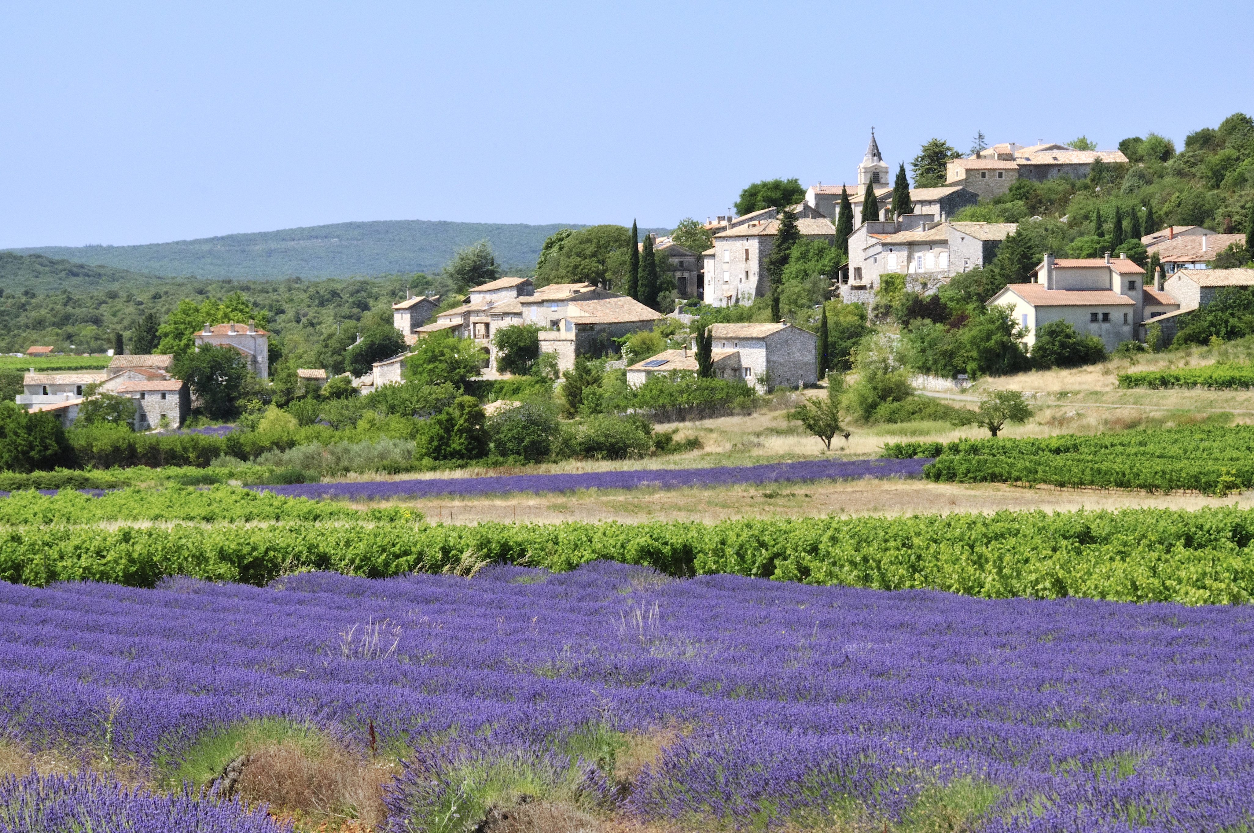
BIDON
Around Bidon
Easy
2h15
8,2km
+90m
-91m
Loop
GR
PR
Es handelt sich um eine recht einfache Route, die hauptsächlich auf breiten Wegen ohne große Steigungen verläuft.
Embed this item to access it offline
This quiet route takes in the garrigue and oak forest of the Ardèche, as well as lapiaz (limestone slabs sculpted by the elements).
Description
From the hiking information board, take the small road that leaves to the left of the town hall towards the Plaine d'Aurèle.
At the ‘Puits de la Vieille’ signpost, follow the signs for ‘St Remèze’ via ‘La Charrette’ by taking the road that runs parallel to the one you have just come from. After 50 m, turn right up to the church square and continue to the left until you reach the cross.
When you reach the calvary, turn right onto the paved road, which becomes a dirt track a little further on. Follow it to the left. At the next fork, turn left then right and follow the path between the dry stone walls. At the end of the path, turn right then left. At the ‘La Charrette’ signpost, head towards ‘Grottes de Saint-Marcel’ via ‘Le Pouzat’. Cross the departmental road and take the small road that branches off slightly to the right. When this turns into a wide dirt track, continue straight ahead. Stay on the main track until you reach the ‘Le Clos de Goudaud’ signpost. Take the direction of ‘Plaine du Cayre’ (to the left).
Follow the main path to the D690. Cross and take the dirt track opposite.
At the next two crossroads, turn left. When you reach a fork approximately 600 m after the second crossroads, take the right-hand path.
At the ‘Plaine du Cayre’ signpost, follow the direction of Bidon via ‘Grand Champ’.
At the ‘Grand Champ’ signpost, go straight ahead (direction ‘Bidon 0.8 km’) and, at the next fork, go straight ahead again. Cross the D201 and continue on the road until you reach an iron cross. Take the pavement for the shortest route; or turn right to pass through the largest sinkhole in France. This is a collapse of the ground caused by the dissolution of rock by water. Then take the path that branches off to the left towards a farm; and when you reach the road, turn left to return to the starting point.
- Departure : Hiking information board (under the bus shelter) Town Hall Square
- Arrival : Hiking information board (under the bus shelter) Town Hall Square
- Towns crossed : BIDON and SAINT-REMEZE
Forecast
Altimetric profile
Information desks

Office de Tourisme Gorges de l'Ardèche - Bourg-Saint-Andéol
Place du Champ de Mars, 07700 Bourg-Saint-Andéol
Office de Tourisme Gorges de l'Ardèche - Larnas
Le Village, 07220 Larnas

Office de Tourisme Gorges de l'Ardèche - Saint-Martin-d'Ardèche
1 Pl. de l'Église, 07700 Saint-Martin-d'Ardèche
Access and parking
From Vallon-Pont-d'Arc, take the D4 towards Bourg-Saint-Andéol. Shortly after Saint-Remèze, turn right onto the D201 until you reach the small village square.
From Saint-Martin-d'Ardèche take the Route touristique des Gorges towards Vallon-Pont-d'Arc and +/- 5 km after the Grotte de St-Marcel take the D690 towards Bidon.
From Bourg-Saint-Andéol, take the 'Route de Bidon' (D358) at the roundabout west of Bourg, right next to the bridge over the railway line, then take the D 201 to the right.
Parking :
Town hall square in Bidon
Report a problem or an error
If you have found an error on this page or if you have noticed any problems during your hike, please report them to us here: