From Lanas to Balazuc
Climbs and descents on very rocky paths
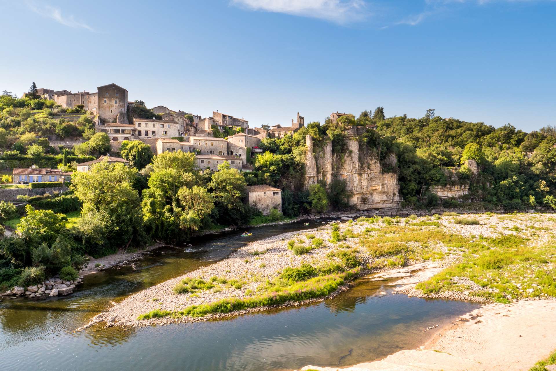
Holm oak and white oak woods, open views, riverside, rocky terraces, limestone cliffs, rocky paths.
Description
- From the hiking information board, take the small street below the access to the bridge over the Ardèche. At the hiking signpost, take the ‘rue des Chèvres’ on the right. Stay on this road, turning left at each intersection. Take the path that climbs to the right between the last two houses outside the village. After a steep, rocky climb, the path levels out.
- At the ‘Le Clauzel’ signpost, follow the direction of ‘Balazuc’ by taking the path to the left. 100 m beyond the signpost, do not take the path that branches off to the left. Continue to follow the white and yellow markings and stay on this stony path, which is often in the undergrowth. After descending, you will arrive at a road. Turn right.
- At the ‘Les Chabasses’ signpost, continue along the road to the centre of the hamlet of Servières, 170 m away. At the two hiking signposts fixed to a large rock on the left, descend to the right to go to Balazuc. Then take the road on the right to the bridge 1.2 km away.
- Cross the bridge, climb a little and then take the path on the left. When you reach the village, turn right and then take the second alley on the left. This is where the pretty alleys of the village begin. When you come to a slightly wider street, turn right and then left. Take the second alley on the right and then go down to the left until you reach the main street. Walk up it a little (towards the left) and take the first street that goes down to the right. At the end of this alley, turn right.
- At the next intersection, walk up a little to the right to return to the bridge road (to go to the beach, walk down to the left). Cross the bridge again. Walk back along the small road in the opposite direction to the hamlet of Servières.
- Go up the small street and turn right towards ‘Lanas 2.8 km by the river’. After passing under a vaulted passage, you will come out onto the balcony path between the cliff and the river. 900 m further on, don't miss the Estinettes resurgence. This is where a natural staircase of high steps leads down to the water. Continue along the path that runs alongside the Ardèche river and then climbs for +/- 400 m. When it joins another path, descend to the right. When you reach a track suitable for vehicles, take it to the left until you reach Lanas.
- Departure : Lanas hiking information board
- Arrival : Lanas hiking information board
- Towns crossed : LANAS and BALAZUC
Forecast
Altimetric profile
Recommandations
Make sure to take enough water to drink and protect yourself from the sun.
Good walking shoes, and possibly walking sticks. Swimming costume and towel in summer
Information desks

Office de Tourisme Gorges de l'Ardèche - Ruoms
9 rue Alphonse Daudet, 07120 Ruoms

Office de Tourisme Gorges de l'Ardèche - Vogüé
52 Rue Grande Rue, 07200 Vogüé
Access and parking
From Aubenas: take the D579 then the D114 to Saint-Maurice-d'Ardèche. From Montélimar: N102 then D103 then D579 and D114. From Vallon-Pont-d'Arc and Ruoms: take the D579 then the D114.
Parking :
Report a problem or an error
If you have found an error on this page or if you have noticed any problems during your hike, please report them to us here: