From Vogüé to Lanas
VOGUE
From Vogüé to Lanas
Easy
2h15
7,5km
+119m
-116m
Loop
Apart from a section on a slightly rocky and steep path, the rest of the route is on roads and wide paths.
Embed this item to access it offline
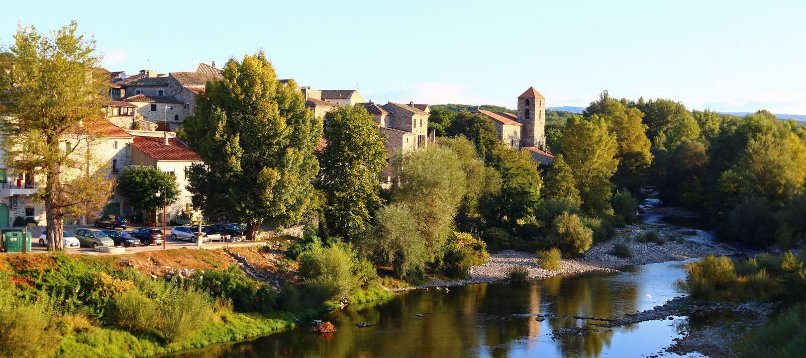
Roads, paths and trails near the Ardèche and in its plain. But above all, two beautiful villages.
Description
You can start by visiting the village of Vogüé or save it for last. Don't miss this charming village, ranked among the most beautiful in France.
To start the circuit, from the tourist information office, cross the nearby bridge and turn left. From the Tourist Office: take the bridge over the Ardèche, then turn left (towards ‘Via Ardèche’). Follow the signs carefully. Pass the holiday village and continue straight ahead (at the hiking signpost (1), towards ‘Lanas’).
Cross the RD and follow the road towards Lanas. Turn left at the first street, which descends and turns into a path that goes around the campsite on the left. At the end of the campsite, turn right, then left onto a path through the woods. This path will bring you closer to the river before taking you to the church in Lanas.
At the signpost (2) at the entrance to the village, take the lane on the left and go downhill. Just before the balcony that marks the end of the lane, turn right, then go downhill to the left towards the square. Cross the square to the left until you reach the hiking information sign.
This sign is the starting point for the loop that leads to Balazuc and returns along the Ardèche. From there, take the bridge over the Ardèche.
From the ‘Le Moulin’ signpost (3), turn right onto the path that passes under the bridge, then over a submersible bridge. It joins the road to the campsites, which leads to the roundabout at the pharmacy. From there, return to the village by continuing to follow the PR markings to the right, then cross over to the ‘Bausson’ signpost (4), from where you must climb to the top of the hill. At the ‘Château d'eau’ signpost (5), descend to the left. At the barrier, if you continue straight ahead, you can go to the blue stone quarry. Then take the wide path that descends to the village. It passes by the chapel of La Gleyzette or St-Cerice (6) and offers beautiful views of the castle and the village. To return to the starting point, go around the church on the left.
- Departure : Vogüé Tourist Office
- Arrival : Vogüé Tourist Office
- Towns crossed : VOGUE, LANAS, and SAINT-MAURICE-D'ARDECHE
Forecast
Altimetric profile
Recommandations
Auf den Straßen dieser Route sollten Sie besser links gehen.
Information desks

Office de Tourisme Gorges de l'Ardèche - Ruoms
9 rue Alphonse Daudet, 07120 Ruoms

Office de Tourisme Gorges de l'Ardèche - Vogüé
52 Rue Grande Rue, 07200 Vogüé
Access and parking
From Aubenas: take the D579 then the D579A. From Montélimar: take the N102 then the D103 then the D579 and D579A. From Vallon-Pont-d'Arc and Ruoms: take the D579 then the D579A.
Parking :
Vogüé beach car park or car park under the Vogüé cemetery
Report a problem or an error
If you have found an error on this page or if you have noticed any problems during your hike, please report them to us here: