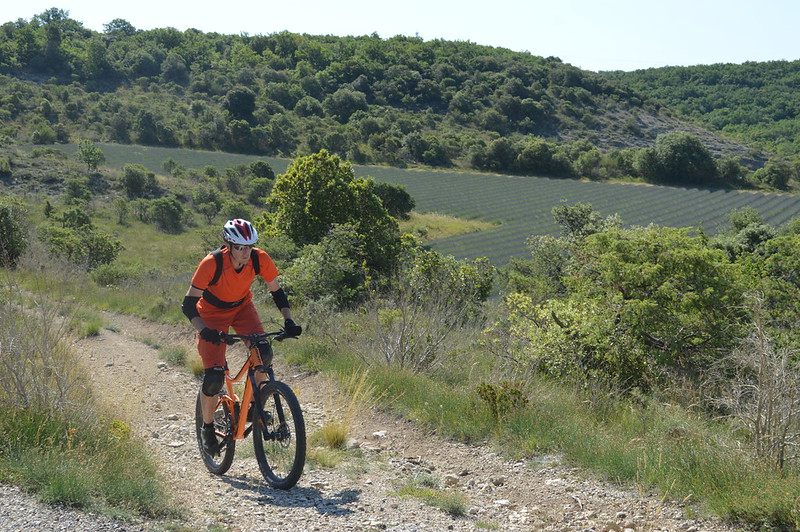
Mountain biking around Larnas
Although short, this route features a few steep sections both uphill and downhill, as well as some slightly technical sections. If you’re looking for a greater challenge, you can do the route in the opposite direction: it offers some great challenges and different views.
This route is particularly beautiful in spring, when the wildflowers are in bloom, and from mid-June to mid-July, when the lavender fields on the Laoul plateau are in full bloom.
In May, go and see the irises in the Nègue Valley, at Gerbaut (a return trip by road with a significant elevation gain)
Description
When you are facing the hiking information sign, next to Larnas Town Hall, turn right and walk past St Pierre’s Church (well worth a visit). Follow the 2 and markers. Walk up the small road until you reach the high-voltage power lines. At an electricity pylon, leave the road and take the path on the right. Do not turn right towards the pylons or left towards the road.
Continue along this path to the ‘Bois de Deniéret’ signpost (1).
There, head towards Viviers and follow the path down through the forest. When you reach a hunter’s hut, turn left towards the tarmac road and left onto it.
At the farm on a ridge, continue straight ahead (signposted and , you leave the ); and, at the fork shortly afterwards, do not go towards Larnas on the left but take the dead-end road in front of you.
At the end of this road, go straight on and take the path through the forest. When this leads onto a wider track, turn left; and, at the next junction (about 400m further on): signpost ‘Gandaubert’ (2). Turn left towards Larnas – Fontaine du Buis.
Stay on this track until you reach a tarmac road. From La Croix, there is a beautiful view of the Nègue valley to the right. Take the road to the left for 80 m, then turn right onto the path that climbs.
Continue along this path, and at the second junction turn right, following the PR markings. Turn left onto the tarmac road; and, 270 m further on, turn right onto the path crossing the lavender fields.
Stay on this path for approx. 900 m, then turn left onto a path between two dry stone walls (known as clapas).
Continue along this path, which joins a tarmac road, and proceed to the junction with the D262. Cross over. At the wayside shrine, signpost ‘Fontaine des Buis’ (3), follow signs for St-Montan.
Stay on the wide path that climbs up to the signpost “Bas Rocher” (4). From there, follow: Larnas 1.1 km via La Peyrière
Follow the path to the signpost: “La Peyrière” (5). From there, follow: Larnas 0.7 km, taking the path that descends to the left. Caution: narrow, rocky descent.
Continue along this path. You may need to go through a gate to continue straight on at the end of the descent (do not go up to the left). In the village, walk past the fountain, then under the arch to reach the town hall.
- Departure : Hiking information board – Larnas Town Hall
- Arrival : Hiking information board – Larnas Town Hall
- Towns crossed : LARNAS, SAINT-MONTAN, and GRAS
Forecast
Altimetric profile
Recommandations
Take care in wet weather; limestone slabs can be very slippery if there is mud on your tyres.
A good mountain bike...
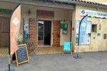
Information desks

Office de Tourisme Gorges de l'Ardèche - Bourg-Saint-Andéol
Place du Champ de Mars, 07700 Bourg-Saint-Andéol
Office de Tourisme Gorges de l'Ardèche - Larnas
Le Village, 07220 Larnas

Office de Tourisme Gorges de l'Ardèche - Viviers
5 place Riquet, 07220 Viviers
Access and parking
From Viviers, take the D86 southwards, then take the D262 towards Saint-Montan. Drive through the village and continue on the D262 through the Gorges de la Sainte-Baume to Larnas.
From Vallon-Pont-d'Arc, take the D4 towards Saint-Remèze, then the D262 towards Larnas.
From Saint-Martin-d'Ardèche, join the D86 then pass through Saint-Just-d'Ardèche; bypass Bourg-Saint-Andéol, and at the roundabout at the end of the bypass, take the 2nd exit then the 1st road on the right: the D190 to Saint-Montan, then the D262 to Larnas.
Parking :
Report a problem or an error
If you have found an error on this page or if you have noticed any problems during your hike, please report them to us here: