The great path of the Chapels
SAINT-JUST-D'ARDECHE
The great path of the Chapels
Medium
5h42
18,6km
+357m
-357m
Loop
GR
PR
Embed this item to access it offline
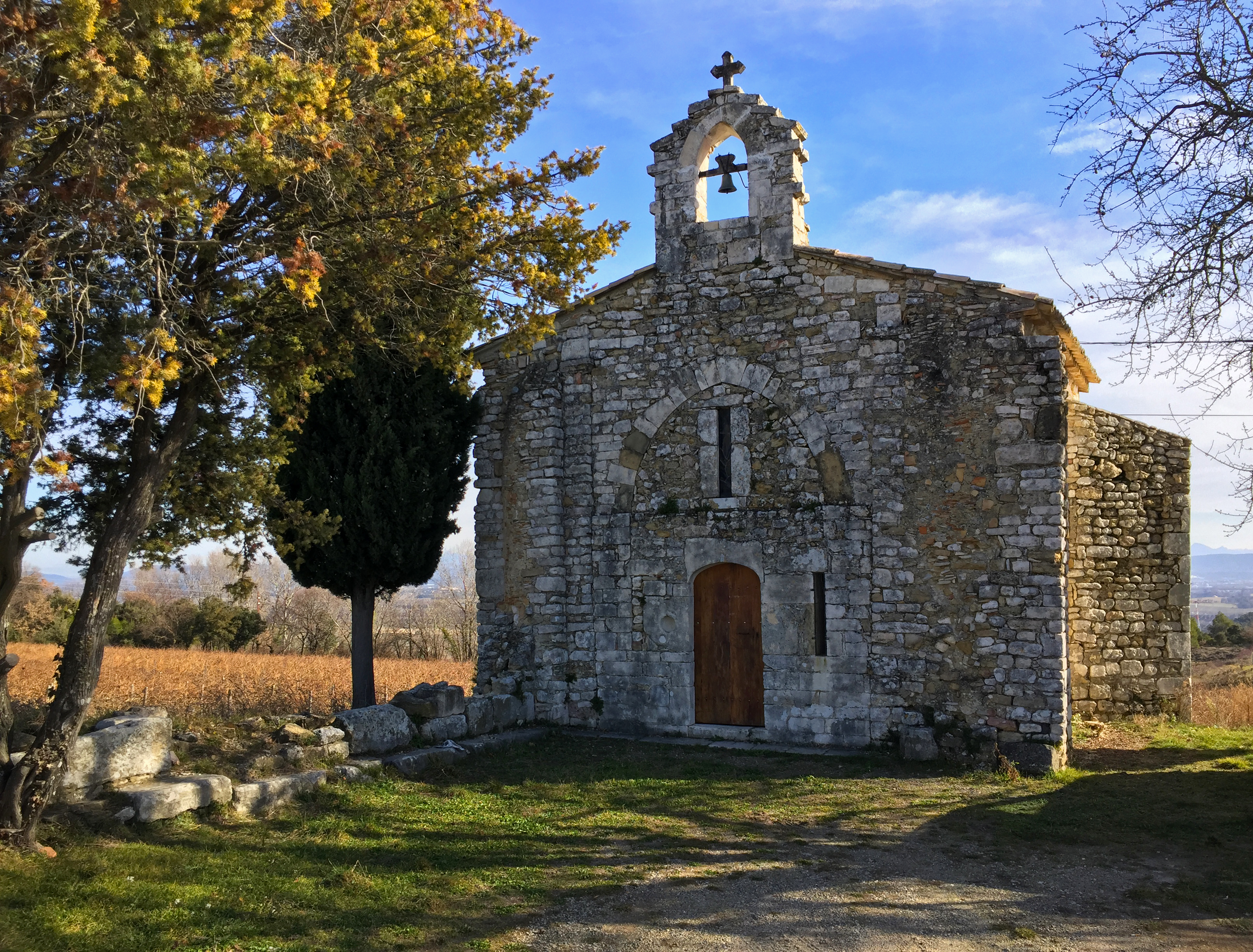
This varied route will take you to discover four typical Romanesque chapels nestled in the hills and two villages. You'll sometimes follow the small roads of the Provençal Ardèche, sometimes on paths through vineyards and fields, and sometimes along trails through the woods.
Description
From the sign, go past the wash-house and head west. Then take rue de Versailles (small street on the left just beyond the church forecourt). Always follow the white and yellow signs (PR). When you reach the Route de Saint-Martin, turn left.
- At the Chemin de la Croix Vieille signpost, turn right towards Chaveyron (2.2 km) and take the Chemin de la Croix Vieille. At a 5-way crossroads, take the Chemin de la Joinade on the left as far as the recently restored Chapelle Notre Dame de la Salette.
- After visiting the chapel, turn right onto the Chemin des Salettes, which climbs steadily up to the crest of the Chaveyron hill. At the Chaveyron signpost, turn left towards Saint-Martin via Peyrobe (0.1 km). For the 18.3 km route, head towards Saint-Marcel d'Ardèche.
- At the first crossroads, turn right and continue along the road until you reach the square in front of the old post office in St-Marcel, where you'll find a signpost with walking information. From here, pass the square with the wash-house and take the small ‘rue de la Fontaine de Viviers’ on the right. Turn right into the square and then left into the 1st street. Then turn right along the church. At the end of Rue du Barry, turn left, then 1st right, then 1st left.
- After 80 m, take the road on the right which climbs steeply towards St Joseph's chapel. Continue along this road and, at a fork in the road, do not turn right. At the end of a wood on your right, turn left. At the ‘T’ turn left and then right at the 1st track. Continue along the main path until you reach a small tarmac road. At this point, turn right for 130m.
- At the Souchas sign, follow signs for Chapelle St-Julien (0.3 km). At the Chapelle Saint-Julien post, after admiring the chapel and its bucolic setting, retrace your steps. At the Souchas signpost, turn right towards La Capelade (0.7 km) and follow the white and red GR 42 signs. When the road bends to the left, continue straight ahead on the path. When you reach the main road, cross it and turn right for 40m. At the La Capelade signpost, turn left towards Plan de Lage (0.5km). At the Plan de Lage sign, turn left towards Lafare (0.4km).
- At the Lafare signpost, turn right towards Peyrobe (1.3 km). Always follow the GR 42 (white and red markings), which takes the dirt track bordered by vineyards on the left and wooded slopes on the right. At the Peyrobe signpost, go down the road towards Malherte (1.3 km).
- At the Malherte signpost leave the GR 42 and take the PR (white and yellow markings) to the right, signposted Chapelle Saint-Sulpice. After +/- 300 m leave the road and follow the path to the left. Turn left at the fork, then descend and cross the small stream. Go up to the right and come to a wide path, take it to the right and follow it until you come to a vineyard on your left.
- At the Chapelle Saint-Sulpice post, turn left towards Trignan Haut (1.4 km). After 100 m, turn left to see the Romanesque chapel of Saint-Sulpice, built in the middle of vines and groves. There are Carolingian reused stones. Then return to the PR and turn left (south) and follow the road to the entrance to the hamlet of Trignan. At the Trignan Haut signpost, continue straight on towards Trignan Bas (0.2 km).
- At the Trignan Bas signpost, turn left onto the road to Saint-Just via Vachère (2.1 km).
- After 500 m, at a metal enclosure, take the left-hand path up and then down through the vines. The path becomes a footpath and climbs steeply for a few metres. Continue along this pretty path without turning right; go down to the left. The path widens, descends and comes to a house. Take the road and continue along it without forking.
- At the Vachère signpost, turn left towards Saint Just and follow the road. From the Chemin de la Croix Vieille signpost (0.5 km), follow the signs to rue de Versailles and continue to the starting point.
- Departure : Barry Square
- Arrival : Barry Square
- Towns crossed : SAINT-JUST-D'ARDECHE, SAINT-MARCEL-D'ARDECHE, and SAINT-MARTIN-D'ARDECHE
Forecast
Altimetric profile
Information desks

Office de Tourisme Gorges de l'Ardèche - Bourg-Saint-Andéol
Place du Champ de Mars, 07700 Bourg-Saint-Andéol

Office de Tourisme Gorges de l'Ardèche - Saint-Martin-d'Ardèche
1 Pl. de l'Église, 07700 Saint-Martin-d'Ardèche
Access and parking
From Aubenas or Montélimar, take the D86 to Saint-Just-d'Ardèche, following the Rhône.
From Vallon-Pont d'Arc, take the D290 or the Route des Gorges to Saint-Martin-d'Ardèche and then Saint-Just-d'Ardèche.
From Bollène or Bagnols-sur-Cèze, join the D86 from Pont-Saint-Esprit to reach Saint-Just-d'Ardèche.
Park in one of the parking lots near the church.
From Vallon-Pont d'Arc, take the D290 or the Route des Gorges to Saint-Martin-d'Ardèche and then Saint-Just-d'Ardèche.
From Bollène or Bagnols-sur-Cèze, join the D86 from Pont-Saint-Esprit to reach Saint-Just-d'Ardèche.
Park in one of the parking lots near the church.
Parking :
19 maart 1962 Plein of Kerkplein
Report a problem or an error
If you have found an error on this page or if you have noticed any problems during your hike, please report them to us here: