The Chapelles path from St-Just
SAINT-JUST-D'ARDECHE
The Chapelles path from St-Just
Easy
3h30
11km
+249m
-249m
Loop
GR
PR
Embed this item to access it offline
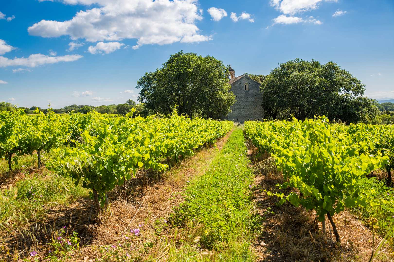
On this varied route, you will discover 2 typical Romanesque chapels hidden in the hills and 1 village. Sometimes you travel on small roads in the Provençal Ardèche, sometimes on paths through vineyards and crops, sometimes on paths through the woods.
Description
From the signpost, pass by the wash house [1] and head west. Then take Rue de Versailles (a small street on the left just past the church square). Continue to follow the white and yellow markings (PR). When you reach Route de Saint-Martin, turn left.
- At the Chemin de la Croix Vieille signpost, turn right towards Chaveyron (2.2 km) and take the Chemin de la Croix Vieille. When you reach a 5-way intersection, take the Chemin de la Joinade on the left until you reach the recently restored Notre Dame de la Salette Chapel.
- After visiting the chapel, turn right and take the Chemin des Salettes, which climbs steeply to the crest of the Chaveyron hill.
- At the Chaveyron signpost, turn left towards Saint-Martin via Peyrobe (0.1 km). Join the GR 42 (white and red markings) which follows the dirt track lined with vineyards on the left and wooded slopes on the right. At the Peyrobe signpost, descend the road towards Malherte (1.3 km).
- At the Malherte signpost, leave the GR 42 and take the PR on the right, towards the Chapelle Saint-Sulpice. After +/- 300 m, leave the road and follow the path on the left. At the fork, go left, then descend and cross the small stream. Go up to the right and arrive at a wide path, take it to the right and follow it until you go around the vineyards on your left.
- At the Chapelle Saint-Sulpice signpost, turn left towards Trignan Haut (1.4 km). After 100 m, turn left to see the Romanesque chapel of Saint-Sulpice, built among vineyards and groves. It features reused Carolingian stones. Then return to the PR and turn left (south) and follow the road to the entrance to the hamlet of Trignan. At the Trignan Haut signpost, continue straight on towards Trignan Bas (0.2 km).
- At the Trignan Bas signpost, turn left onto the road towards Saint-Just via Vachère (2.1 km). After 500 m, at a metal enclosure, take the path on the left, climb up and then descend between the vineyards. The path becomes a trail and climbs steeply for a few metres. Continue along this pretty trail without turning right, descending to the left. The path widens, descends and arrives at a house. Take the road and continue along it without turning off.
- At the Vachère signpost, turn left towards Saint-Just and follow the road. From the Chemin de la Croix Vieille signpost [2] 0.5 km away, return to the starting point by following the signs towards Rue de Versailles. From there, descend towards the centre of the village of Saint-Just-d'Ardèche.
- Departure : Barry Square
- Arrival : Barry Square
- Towns crossed : SAINT-JUST-D'ARDECHE, SAINT-MARCEL-D'ARDECHE, and SAINT-MARTIN-D'ARDECHE
Forecast
Altimetric profile
Information desks

Office de Tourisme Gorges de l'Ardèche - Bourg-Saint-Andéol
Place du Champ de Mars, 07700 Bourg-Saint-Andéol

Office de Tourisme Gorges de l'Ardèche - Saint-Martin-d'Ardèche
1 Pl. de l'Église, 07700 Saint-Martin-d'Ardèche
Access and parking
From Aubenas or Montélimar, take the D86 to Saint-Just-d'Ardèche, following the Rhône.
From Vallon-Pont d'Arc, take the D290 or the Route des Gorges to Saint-Martin-d'Ardèche and then Saint-Just-d'Ardèche.
From Bollène or Bagnols-sur-Cèze, take the D86 from Pont-Saint-Esprit to Saint-Just-d'Ardèche.
Park in one of the car parks near the church.
From Vallon-Pont d'Arc, take the D290 or the Route des Gorges to Saint-Martin-d'Ardèche and then Saint-Just-d'Ardèche.
From Bollène or Bagnols-sur-Cèze, take the D86 from Pont-Saint-Esprit to Saint-Just-d'Ardèche.
Park in one of the car parks near the church.
Parking :
19 March 1962 Square or Church Square
Report a problem or an error
If you have found an error on this page or if you have noticed any problems during your hike, please report them to us here: