
Mountain Biking - The Bessas Plain
A small village on the border with the Gard, offering a beautiful view from the town hall car park. A stroll along the garrigue paths.
Description
-
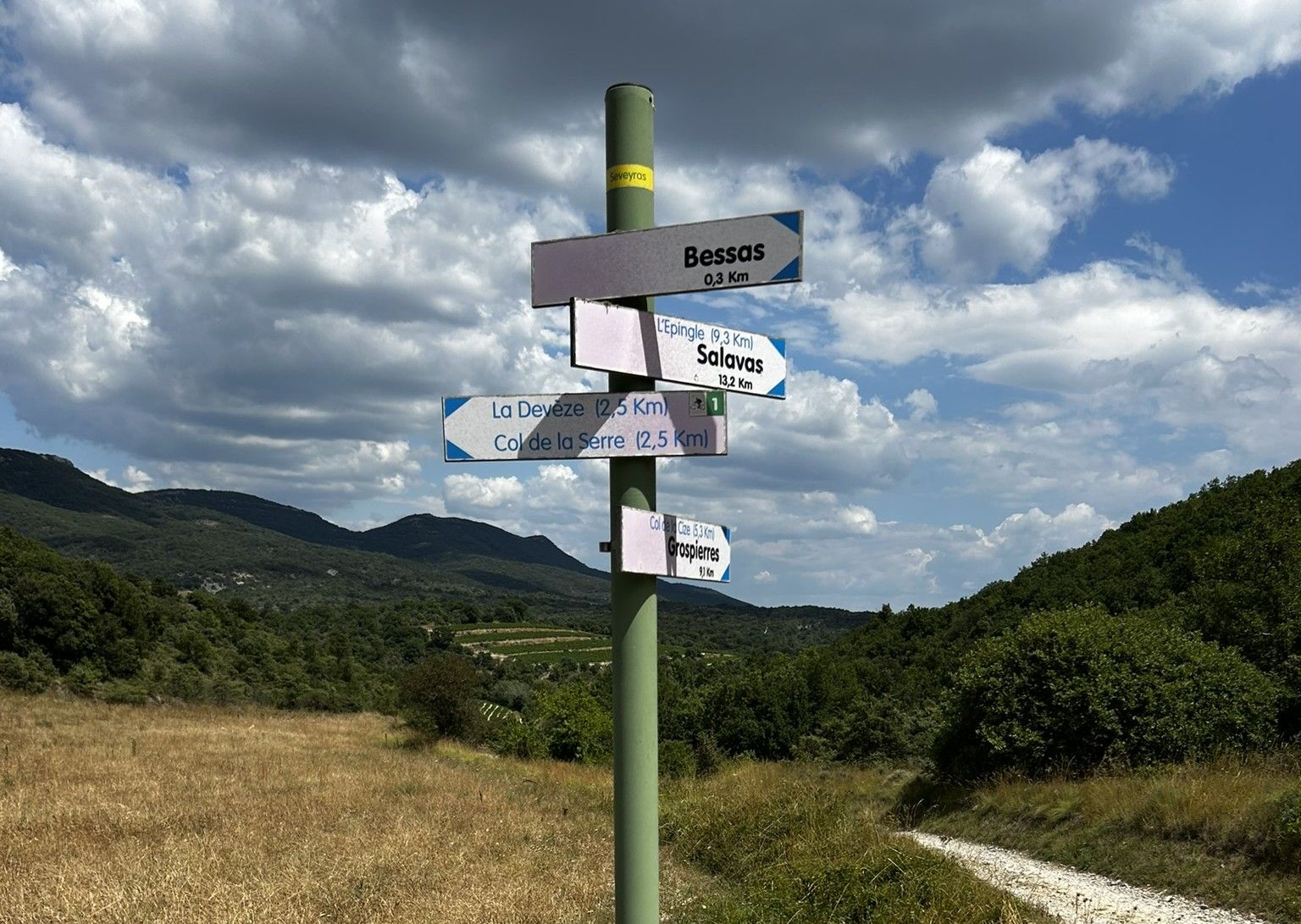
To help you get started, use the small map in the top left-hand corner of the ‘Info Rando’ sign. From the ‘Info Rando’ sign in the car park below the town hall, follow the road up to the street above the town hall. Follow the signposts to the Seveyras junction. Follow signs for La Devèze / Col de la Serre. Continue for a few metres to the La Clapouze junction. Follow signs for La Devèze.
-
When you reach the D 202 road, turn right for 200 m, then leave the road and take a tarmac track on the left until you reach the La Devèze junction.
-
Follow signs for Barjac / Bessas. A few metres past the junction, turn right onto a dirt track that passes in front of a farm building. At the next crossroads, continue straight ahead. Cross a small ditch, then turn left. After 350 m, leave the track and follow a path running alongside a field. After crossing a stream (which is often dry), rejoin a dirt track that leads onto the D 55 road. Continue straight ahead. Just before a bridge, turn right. Cross a stream, then rejoin a track that passes in front of a house.
-
At the next junction, turn left until you reach the Croix de Domergue turn-off. Follow signs for Bessas. The track joins the D 202 road. Turn left, then right onto the D 255 road. A few metres further on, turn left onto a footpath through the fields which leads into the village. Return to the car park, passing in front of the church and its remarkable altarpiece.
- Departure : Bessas - Car park of the Town Hall
- Arrival : Bessas - Car park of the Town Hall
- Towns crossed : BESSAS and BEAULIEU
Forecast
Altimetric profile
Recommandations
Information desks
Office de Tourisme Gorges de l'Ardèche - Ruoms
9 rue Alphonse Daudet, 07120 Ruoms
Office de Tourisme Gorges de l'Ardèche - Vallon-Pont-d'Arc
16 rue des Abeilles, 07150 Vallon Pont d’Arc
Access and parking
From Vallon Pont d’Arc, head towards Salavas and then Vagnas (D579). At the traffic lights, take the D255 and drive through Brujas. At the junction with the D202, turn right. At the next junction, follow signs for ‘Centre Bourg’.
From Ruoms, take the D579 southwards and, at the roundabout with the D11, turn right towards Grospierres / Alès. Pass through Grospierres Gare and, when you reach the roundabout with the D104, turn left and continue for 150 metres. Continue on the D255 for 850 metres; turn left onto the D202 and continue for about a kilometre (you will cross the Col de la Serre) towards Bessas. Drive into the village and park in the car park next to the town hall.
Parking :
Report a problem or an error
If you have found an error on this page or if you have noticed any problems during your hike, please report them to us here: