Rochecolombe, the Royal Road and St-Maurice-d'Ibie
A long route, partly along rocky paths and with quite a bit of elevation gain
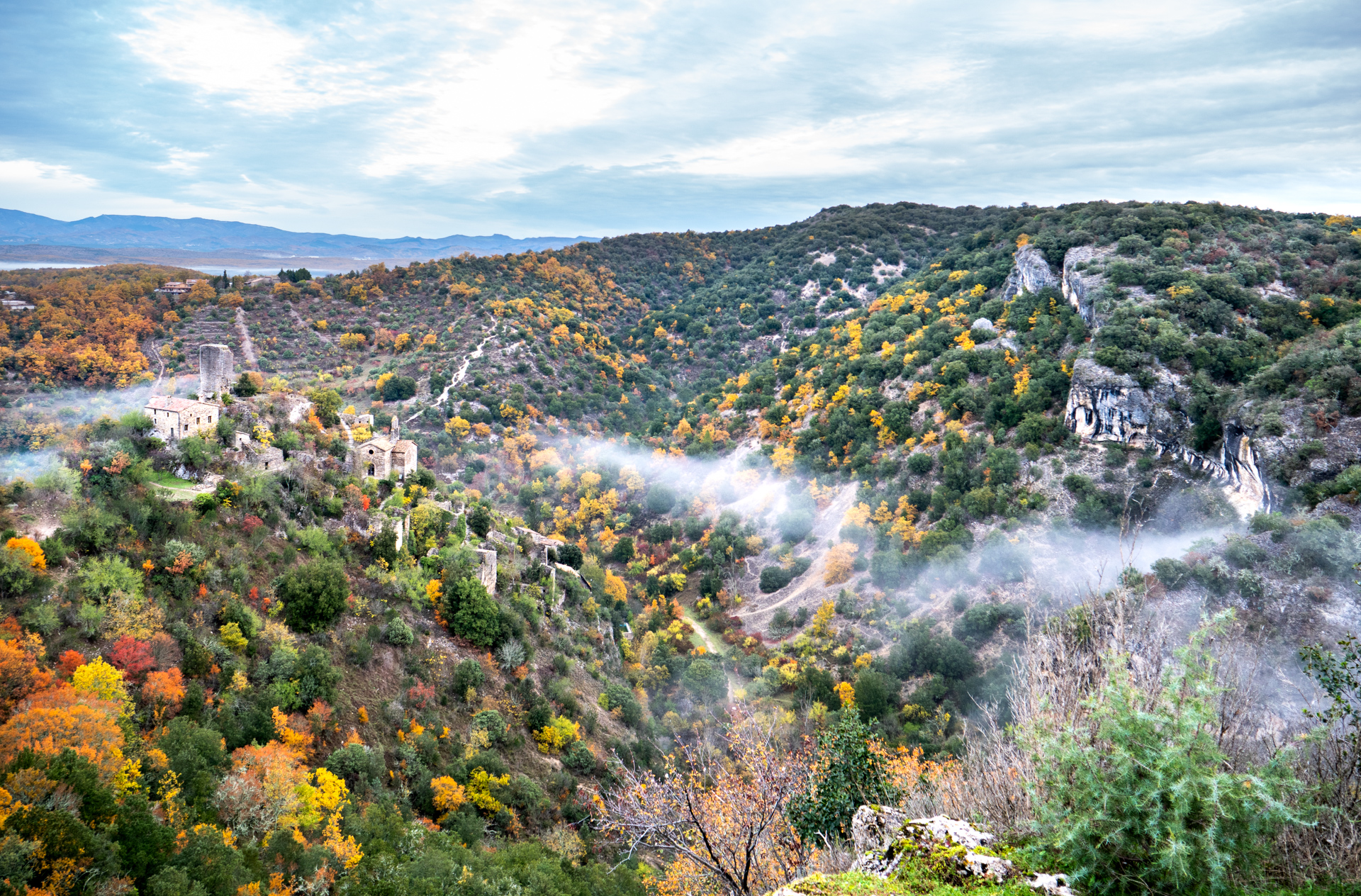
A stunning walk that highlights the work of water,
which is largely absent, yet has carved out numerous ravines in the limestone.
Description
From the Info Rando sign in the square, head towards the war memorial (on the right), then the ‘Rochecolombe’ hiking signpost.
- From there, head towards “Hameau de Leyris 2.2 km”. Keep following the signposts. The path winds its way up above the houses. Go through a gate and take the path on the right. Cross a stream and climb up a path alongside the stream on the right (on the left bank). The path joins a track and continues along the ridge.
- At the signpost “Les Clos”, follow “Valos 4.4 km St-Maurice-d’Ibie 6.2 km” to the left. At the next junction, turn left and continue along the track. Walk past a house, then after 300 m, leave the tarmac road and take a dirt track to the right.
- At the signpost marked ‘Montagu’, follow ‘Valos 1.3 km St-Maurice-d’Ibie 3.8 km’, crossing the Voie Royale. By decision of the Languedoc administrators, the Voie Royale was built to link Villeneuve-de-Berg to the south of the Vivarais in the 17th and 18th centuries. Follow the stony track.
- At the ‘Valos’ signpost, follow the sign for ‘St-Maurice-d’Ibie 2.5 km’ to the left. Head down a stony path.
- At the signpost marked ‘Petit Montagu’. After heavy rain, to avoid an impassable ford, head straight to the ‘L’Ibie’ junction (6) and follow ‘Villeneuve-de-Berg 9.8 km’ to the left. Otherwise, in dry weather, follow ‘St-Maurice-d’Ibie 1.9 km’ to the right. Join a tarmac road and follow it downhill to the village. On leaving the village, turn left onto a tarmac road leading down towards the river. Cross it via a ford
- At the “L’Ibie” signpost, follow “Les Ausses” 100 m.
- At the signpost ‘Les Ausses’, follow ‘Tête de Crespi - Rochecolombe’. The path runs alongside a stream then climbs for approx. 1.5 km
- At the “Tête de Crespi” signpost, follow “Rochecolombe 2.6 km” on the other side of the Route Royale. Head back down and, near a house, continue along a descending path. Follow a stream.
- At the signpost marked ‘Ron Chamorel’, follow ‘Rochecolombe 1.3 km’ to the right. The path overlooks the Vendoule stream (which intermittently feeds the Rochecolombe Waterfall) and leads to a small tarmac road at an old stone farmhouse. Follow the road down to the right, then leave it after 80 m to continue along the path opposite.
- At the ‘Ancien Village’ signpost, follow the sign for ‘Info Rando Rochecolombe 0.4 km’ to the left. Head down a path, then at the junction, continue straight ahead along a cobbled path back to the starting point.
- Departure : Place du Village, 07200 Rochecolombe
- Arrival : Place du Village, 07200 Rochecolombe
- Towns crossed : ROCHECOLOMBE, LAGORCE, and SAINT-MAURICE-D'IBIE
Forecast
Altimetric profile
Recommandations
Take care on limestone slabs, especially when they are wet.
Sturdy shoes and weather-appropriate clothing; water bottle(s) or a hydration pack.
Information desks

Office de Tourisme Gorges de l'Ardèche - Ruoms
9 rue Alphonse Daudet, 07120 Ruoms

Office de Tourisme Gorges de l'Ardèche - Vogüé
52 Rue Grande Rue, 07200 Vogüé
Access and parking
From Ruoms or Vogüé, take the D579, then the D1, then the D401.
Parking :
Report a problem or an error
If you have found an error on this page or if you have noticed any problems during your hike, please report them to us here: