The Monastier
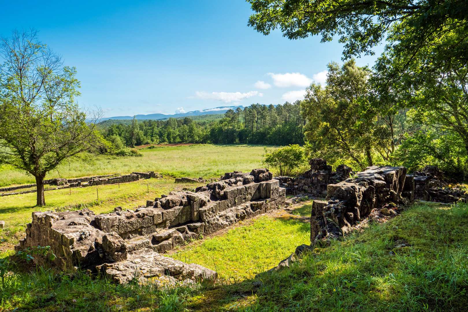
Discover Le Monastier, a 9th-century priory and its ruins, which trace sanctuaries from the Gallo-Roman to the Gothic period and were abandoned around 1300. The monks' washhouse, an inexhaustible resource, and the Roman Antonine road, the Alba-Nîmes axis, highlight the strategic importance of the site and its connection with the first Christians. An exceptional heritage in the Rieusset valley.
Description
- From the Info Rando sign next to the cemetery, walk past the town hall and turn left at the crossroads. Follow Rue de l'École for about 120 metres, then cross the road and follow the sign for the D255 Brujas–Bessas. Walk along the road for 600 metres.
-
Head towards the Le Valadas junction. Follow signs for Rieusset for 4.2 km. Continue straight ahead, then, about 50 m after the climb, turn right at the crossroads. Turn left towards ‘La voie Romaine’, as indicated on the wooden post. Go round the private property on the right, then follow the path along the edge of the forest. Walk downhill for about 250 m before reaching the Ruines du Monastier junction.
-
From this junction, you can take a return trip to the ruins of Le Monastier. Monastier. Follow signs for Grand Chêne (2.1 km) and Salavas (8.9 km). Continue along a narrow path leading to the monks’ old wash house. The path then runs between the spring and the wash house before joining a track. Follow the signs for ‘Le Monastier Retour’. After a descent along a fairly stony path, continue straight on to the next junction, Les Routes. Follow Grand Chêne 0.9 km Salavas 8 km Follow the stream for about thirty metres before reaching a ford. Cross the “Rieussec” stream and continue along this path, which leads onto a tarmac road.
- Turn left onto the road and continue to the Grand Chêne crossroads. Follow signs for Brujas for 2.7 km. Continue straight on until you reach the Champ Lacloque junction.
-
Turn left and follow signs for Vagnas for 2.5 km. After about 300 m, cross a narrow wooden footbridge and continue straight on until you reach the hamlet of ‘Ségriès’. Walk past the house and continue straight on. At the end of the straight stretch, leave the road and turn left onto the path that leads through a wood. It joins a tarmac track running parallel to a road 200 m further on. Join the road and turn left. Follow the road to the Le Valadas junction. Follow signs for Vagnas for 0.8 km. Take the same route as on the way out to return to the starting point.
- Departure : Hiking information panel - cemetery car park
- Arrival : Hiking information panel - cemetery car park
- Towns crossed : VAGNAS
Forecast
Altimetric profile
Recommandations
Drink plenty of water and protect yourself from the sun.
Good shoes and possibly walking sticks. Water bottle and hat.
Information desks

Office de Tourisme Gorges de l'Ardèche - Vallon-Pont-d'Arc
16 rue des Abeilles, 07150 Vallon Pont d’Arc
Access and parking
From Vallon-Pont-d'Arc, take the D579 towards Salavas. Stay on the same road. Go straight ahead after the traffic lights, then take the next exit on the left. Drive past the church and park in the town hall square. Take the first exit on the right and you will be back at the starting point.
Parking :
Report a problem or an error
If you have found an error on this page or if you have noticed any problems during your hike, please report them to us here: