Upper trail of the Ardèche Gorges hike
VALLON-PONT-D'ARC
Upper trail of the Ardèche Gorges hike
Hard
6h
12,5km
+311m
-353m
Stage
PR
⚠️ The hike in the Ardèche Gorges is a challenging route. It is intended for experienced hikers and is not recommended for young children.
The trail is very rocky, and there is a significant elevation gain (+/- 500m).
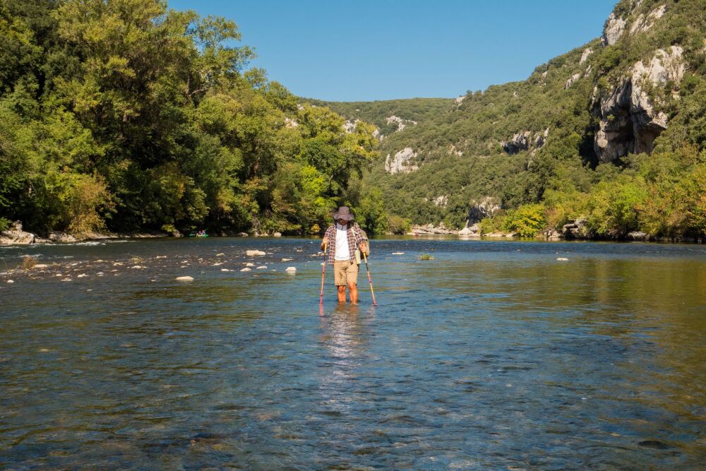
The route follows the river and includes two mandatory fords, handrails and a ladder.
The entire route is only feasible when the river water level is very low. Check before setting off.
The trail is very rocky, and there is a significant elevation gain (+/- 500m).
The route follows the river and includes two mandatory fords, handrails and a ladder.
The entire route is only feasible when the river water level is very low. Check before setting off.
Embed this item to access it offline
Majestic gorges with luminous rocks sculpted by water and time. Protected flora and fauna, typical of limestone cliffs and the Mediterranean climate.
The trail runs along the cliff edge at times and along the riverbank at others, offering numerous opportunities for swimming along the way.
The trail runs along the cliff edge at times and along the riverbank at others, offering numerous opportunities for swimming along the way.
Description
From the Belvédère car park (P3), cross the road and walk up through the "Le Belvédère" hotel car park to take the path on the right that runs above the hotel. At the 1st junction, go left and at the 2nd (250m further on) continue to the right. In the hamlet of Chames, turn left. At the end of the fork in the road, take the middle path straight on. At the fork 300m further on, go down to the right. Just after the bridge, turn right and carefully cross the Gorges tourist road.
- You are now at the entrance to the Nature Reserve and at the start of the signposted historic trail. After 1 km, you will reach the summit of the Montagne de Sable, which you descend to face the Saleyron cliff. The path runs along the Charmassonnet plain as far as the ford (about 1.4 km from the road).
- You need to cross the ford carefully to get to the other side. This is only possible when the water level is low (up to knee level). If the water level does not allow you to cross, retrace your steps. The right bank takes you to the Dent Noire rapids,
- After 1.2 km, the path crosses a rocky section equipped with a ladder with around 15 rungs to make progress easier. Continuing along the path, you pass in front of the Gaud bivouac.
- Approximately 4 km beyond this bivouac, you will come to the Guitard ford post. Follow the signs for Sauze to reach the Gournier bivouac. A signpost indicating the best place to cross has been put up by Nature Reserve staff. Take a stick to help you.
- Departure : Parking 3 ‘Belvédère’ or at Pont du Tiourre, Chames, Vallon-Pont-d'Arc
- Arrival : Gournier campsite, Saint-Remèze
- Towns crossed : VALLON-PONT-D'ARC, LABASTIDE-DE-VIRAC, and SAINT-REMEZE
Forecast
Altimetric profile
Recommandations
Please note! The Ardèche Gorges trail is a linear trail, not a loop. You will therefore need to arrange your own transport by car or with one of the transport companies offering this service.
You can park your vehicle at the Sauze car park in Saint-Martin-d'Ardèche, at car park 3 (Belvédère) at the Pont d'Arc, or at the bus station car park in Vallon-Pont-d'Arc. From there, you can reach the starting point by foot: see the ‘Le Pont d'Arc depuis Vallon’ hike; or take a shuttle bus, which runs in summer and on weekends in May and June.
The hike is not possible all year round due to fords where water levels may be too high. Be sure to check the weather and water levels with the Tourist Office before setting off.
It is possible to leave the nature reserve and return to the Gorges tourist road at the Gaud and Gournier bivouacs, but to complete the entire hike, it is strongly recommended that you spend a night in one of these bivouacs. They are open and staffed from Easter to the end of September. Reservations are required at the Vallon-Pont-d'Arc or St-Martin-d'Ardèche Tourist Offices or on the Ardèche Gorges Tourist Office website.
– The best months to visit are May, June, September and October. Temperatures are cooler and the days are sunny.
– Stay on the trails to protect the flora.
– Be as discreet as possible so as not to disturb the animals that live here.
– Obviously, do not throw rubbish or toilet paper into the countryside.
Good hiking boots. Water shoes and walking sticks for fording. Sun protection. Water bottles or water pouches. Bring sufficient water and food. Camping equipment if not booked at one of the campsites.
A guidebook is available from the information offices of the Ardèche Gorges – Pont d'Arc Tourist Office. It contains a detailed itinerary and lots of information about the fauna, flora and history of the Gorges.
A guidebook is available from the information offices of the Ardèche Gorges – Pont d'Arc Tourist Office. It contains a detailed itinerary and lots of information about the fauna, flora and history of the Gorges.
Information desks

Office de Tourisme Gorges de l'Ardèche - Ruoms
9 rue Alphonse Daudet, 07120 Ruoms

Office de Tourisme Gorges de l'Ardèche - Saint-Martin-d'Ardèche
1 Pl. de l'Église, 07700 Saint-Martin-d'Ardèche

Office de Tourisme Gorges de l'Ardèche - Vallon-Pont-d'Arc
16 rue des Abeilles, 07150 Vallon Pont d’Arc
Transport
Bus line X76 Valence TGV - Montélimar - Vallon-Pont-d'Arc
Bus line E15 Avignon - Vallon-Pont-d'Arc - Aubenas
Pont d'Arc shuttle bus on weekends in May and June + every day in July and August, departing from the Vallon-Pont-d'Arc Tourist Office. Check timetables.
Bus line E20 Pont-St-Esprit - St-Just-d'Ardèche - Bourg-St-Andéol.
Canoe rental companies between St-Martin-d'Ardèche and Vallon-Pont-d'Arc
Access and parking
From Vallon Pont d'Arc, take the D290 towards the Ardèche Gorges.
It is advisable to leave your car in Saint-Martin and book a lift to the starting point with one of the canoe rental companies.
In summer, there are shuttle buses connecting Vallon-Pont-d'Arc to the P3 Belvédère car park.
The departure point can also be just after the Pont de Tiourre bridge.
It is advisable to leave your car in Saint-Martin and book a lift to the starting point with one of the canoe rental companies.
In summer, there are shuttle buses connecting Vallon-Pont-d'Arc to the P3 Belvédère car park.
The departure point can also be just after the Pont de Tiourre bridge.
Parking :
Parking 3 ‘Belvédère’ or in Chames, Vallon-Pont-d'Arc
Report a problem or an error
If you have found an error on this page or if you have noticed any problems during your hike, please report them to us here: