
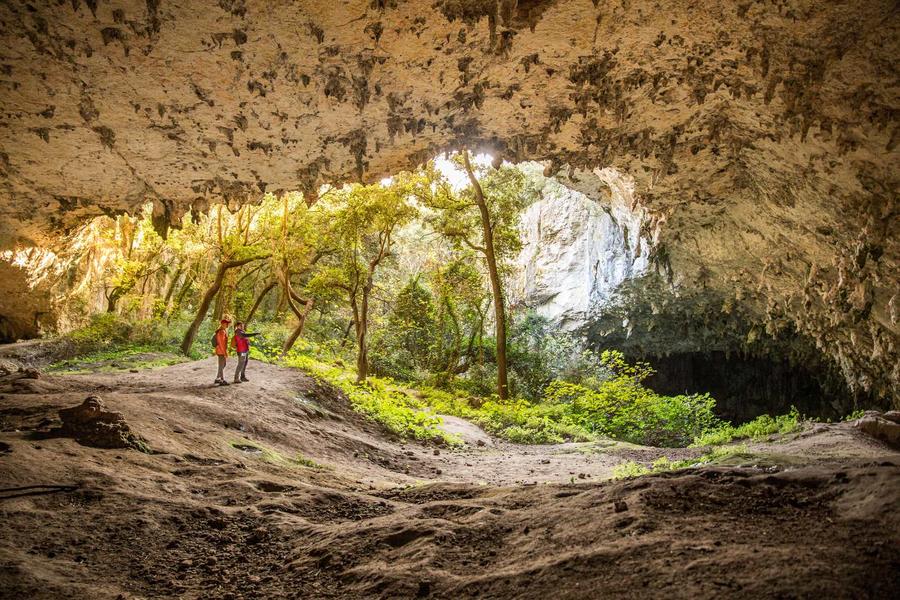
Ronze's shelter
Most of the hike isn't difficult, but the access trail to the cave is steep and very rocky. The limestone slabs and clay areas can be very slippery, so be careful!
A short family hike under the shade of holm oaks, a stone's throw from the Aven d'Orgnac, a Grand Site de France. This site offers an insight into the geological and human history of this immense limestone plateau shaped by history and time, through limestone pavements, potholes, caves, and dolmens.
Description
Departure from the Info Rando sign located to the left of the Aven d'Orgnac and Prehistoric City reception area (Grand Site de France). To make it easier to get started, use the small map in the top left corner of the sign. From there, continue straight ahead towards the natural entrance to the Aven d'Orgnac, following the GR4 trail markers. This vertical shaft, about fifty meters deep, leads to gigantic underground chambers filled with imposing limestone concretions. Columns, stalactites, stalagmites, draperies, and more await you! At the natural entrance to the Aven, follow the small pictograms labeled "Le Maubois."
- At the "Le Maubois" hiking signpost, follow the direction: "L'aven de la Forestière 2.8 km Labastide-de-Virac 5.9 km." Leave the GR and follow the markers to the left. After about 350 m, turn left; the trail passes through the undergrowth before returning to a wider path. Continue to the next intersection, then turn right. About 100 m further, a round trip is possible on the right to La Baume Simonet. Continue past a limestone pavement and then the Cartière Dolmen; and continue descending.
- At the "Cartière" signpost, follow "L'aven de la Forestière 1.1 km Labastide de Virac 4.3 km" to the right. Go back up the path for 100 m. Then take the path on the right, which passes through the heart of the Maubois forest and climbs up to the Aven de la Forestière. Reach the tarmac and take the track on the left 20 m after leaving the site. Continue on this track.
- At the "Colombier" signpost, follow "Dolmen de la Devèze 0.8 km Barjac 5.2 km" straight ahead. Continue along this large trail.
- At the signpost marked ‘La Citerne’, follow the sign for ‘Aven des Cristaux 0.4 km’. Walk past the water tank and continue along this wide track.?
- At the signpost marked ‘Aven des Cristaux’, follow the sign for ‘Aven d’Orgnac 1.7 km’. Then leave the DFCI track and take the track suitable for vehicles which descends to the left. About 300 m past the signpost, leave the track to your right and head down to the left for about 500 m.
- Take the path to the right and then right again after 40 m. Continue for a further 50 m, then turn right onto the path leading to the rocky cirque where the Baume de Ronze is situated. Please note: the path is steep and very rocky. It is very slippery in wet weather. Once you have emerged from the cirque, turn left, then head straight down to rejoin the signposted path you were on (approximately 50 m below where you left it). Head down to the right for approximately 100 m. Then turn left at the clearing and follow it for approximately 100 m. Go straight on at the junction with a path coming from the right and, 20 m further on, turn right at the fork.
- At the "Baume de Ronze" signpost, follow "Aven d’Orgnac 0.5 km" to the right. Continue straight ahead to reach the parking lot for the Grand Site de l’Aven d’Orgnac. Go left to reach the Info Rando sign.
- Departure : Hiking Info panel located to the left of the Aven d’Orgnac reception area
- Arrival : Hiking Info panel located to the left of the Aven d’Orgnac reception area
- Towns crossed : ORGNAC-L'AVEN, LABASTIDE-DE-VIRAC, and BARJAC
Forecast
Altimetric profile
Recommandations
Access to the cave is difficult in wet weather and the entire site is very slippery.
Good shoes and possibly walking sticks. Water bottle and hat.
Information desks

Office de Tourisme Gorges de l'Ardèche - Saint-Martin-d'Ardèche
1 Pl. de l'Église, 07700 Saint-Martin-d'Ardèche

Office de Tourisme Gorges de l'Ardèche - Vallon-Pont-d'Arc
16 rue des Abeilles, 07150 Vallon Pont d’Arc
Transport
Aven d'Orgnac car park
Access and parking
From Vallon Pont d'Arc, follow signs for Vagnas, then head towards Orgnac l'Aven and park at the Aven d'Orgnac site.
From Barjac, head towards Orgnac l'Aven and park at the Aven d'Orgnac site.
Parking :
Report a problem or an error
If you have found an error on this page or if you have noticed any problems during your hike, please report them to us here: