The little path of the Capitelles
BOURG-SAINT-ANDEOL
The little path of the Capitelles
Easy
2h15
7,1km
+0m
0m
Loop
GR
PR
Embed this item to access it offline
A varied circuit, both in terms of the paths taken and the landscapes: between beautiful viewpoints and agricultural plots. Beautiful views of Mont Ventoux and the Rhône plain. White and yellow markings along the entire circuit and white and red (GR 42) on one section.
Description
When you see the hiking information sign behind the Tourist Office, turn left onto Avenue Marc Pradelle.
- At the first intersection, turn right onto Chemin Saint-André (you are now on the GR42, marked white/red). See the sign on the park wall and follow the signs for "Darbousset 1.8 km." Cross the bridge over the railway and continue on this road, which becomes a path and passes under a bridge. You will then see the Château de Bellevue on your left. Continue straight ahead and stay on the GR42.
- After passing a few houses, turn left to cross to the other side of the stream onto a wide path that turns into a trail that climbs quite steeply. After a 1 km climb, a beautiful view of the Rhône Valley awaits you. When you reach the paved road, turn right.
- At the "Darbousset" signpost, leave the GR to take the PR. Follow the white/yellow markings and follow "Bourg-Saint-Andéol 7.5 km." Continue on this wide path for 600m.
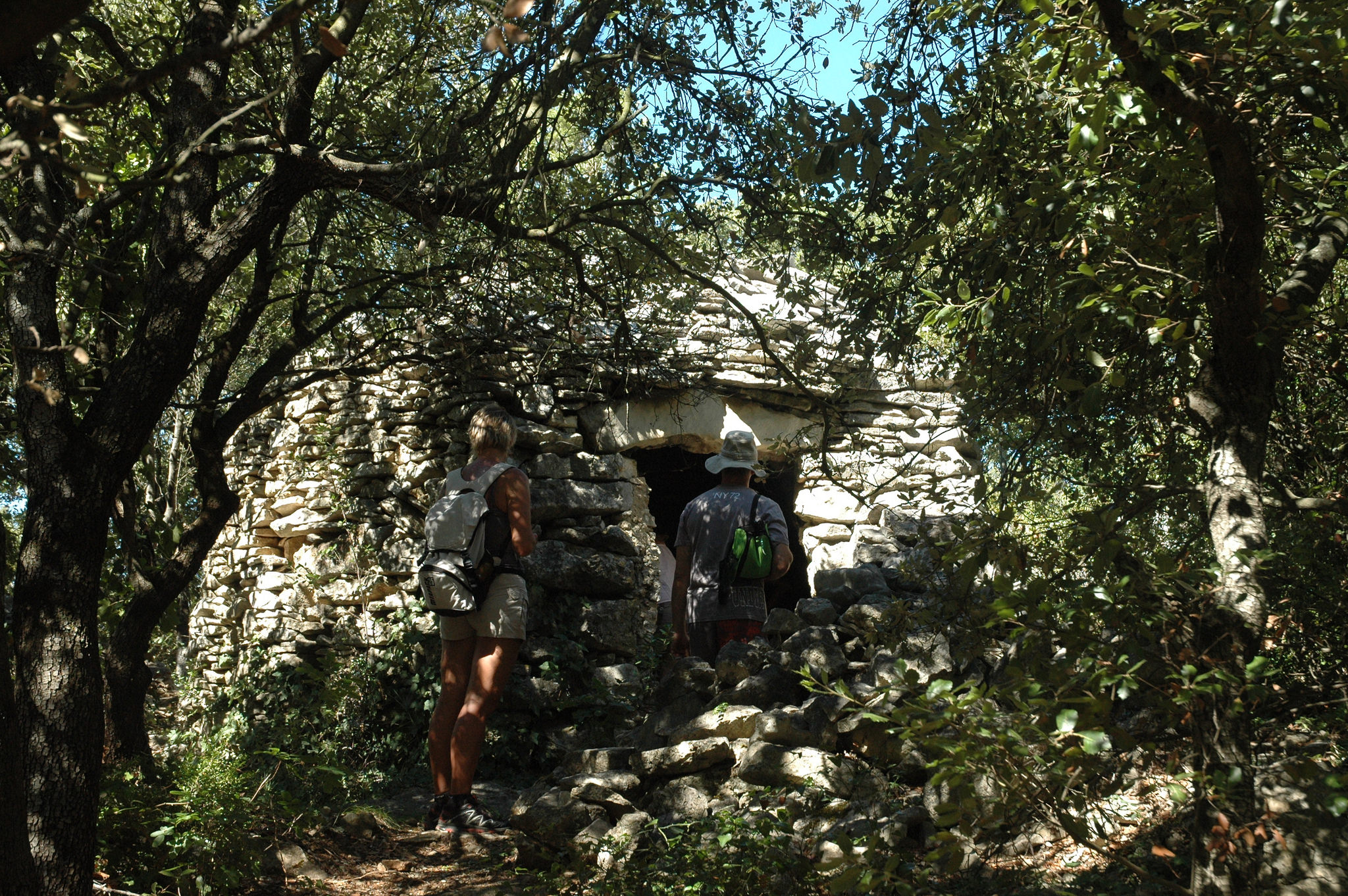
- When you reach a fork, turn left, descend toward the signpost, and follow the signs for "Croix de Romanet 1.8 km" on the right to follow the vineyard. You will come to a shelter on your left (somewhat hidden by vegetation). /!\ These shelters, built of dry stone, are fragile. Entering them is at your own risk! Be careful not to damage them. Take the path between the vineyard and the trees, then continue straight ahead. At the end of the vineyards, go back up to your right through the undergrowth to reach another shelter. From there, turn left. When the path leaves the woods and opens onto a farm track, follow it to the right for 50m to the next signpost. There, turn right towards "Croix de Romanet," the path that descends. After about 250 m, turn right; the path descends steeply to the bottom of the valley.
- Cross the stream and take the path opposite that climbs to the right. At the top of the valley, turn right onto the well-marked farm track until you reach the road and the signpost "Croix de Romanet."
- Take the direction "Seilloux." At the first junction, continue to the right and at the next T-junction, turn left. Go up 250 m and take the small road on the right. At the fork further on, turn left and follow Chemin de la Morelle to the signpost "Seilloux."
- Turn left there and from Croix de Romanet, follow the small road "Coulange 3.1 km." Continue down the road towards "Bourg-St-Andéol 1.4 km." Stay on Avenue de Lattre de Tassigny +/- 750 then go down Rue des Tanneries Amblard (you leave the signposting at the Sainte Croix housing estate). Once you reach the washhouse, go up Avenue Marc Pradelle which will take you back to the Champs de Mars.
- Departure : Tourist Office - Place du Champs de Mars
- Arrival : Tourist Office - Place du Champs de Mars
- Towns crossed : BOURG-SAINT-ANDEOL
Forecast
Information desks

Office de Tourisme Gorges de l'Ardèche - Bourg-Saint-Andéol
Place du Champ de Mars, 07700 Bourg-Saint-Andéol
Access and parking
From Aubenas, take the N102 towards Lavilledieu. Follow the D107 towards Alba-la-Romaine, then take the D86 to Bourg-Saint-Andéol.
Parking :
Champ de Mars Square
Report a problem or an error
If you have found an error on this page or if you have noticed any problems during your hike, please report them to us here: