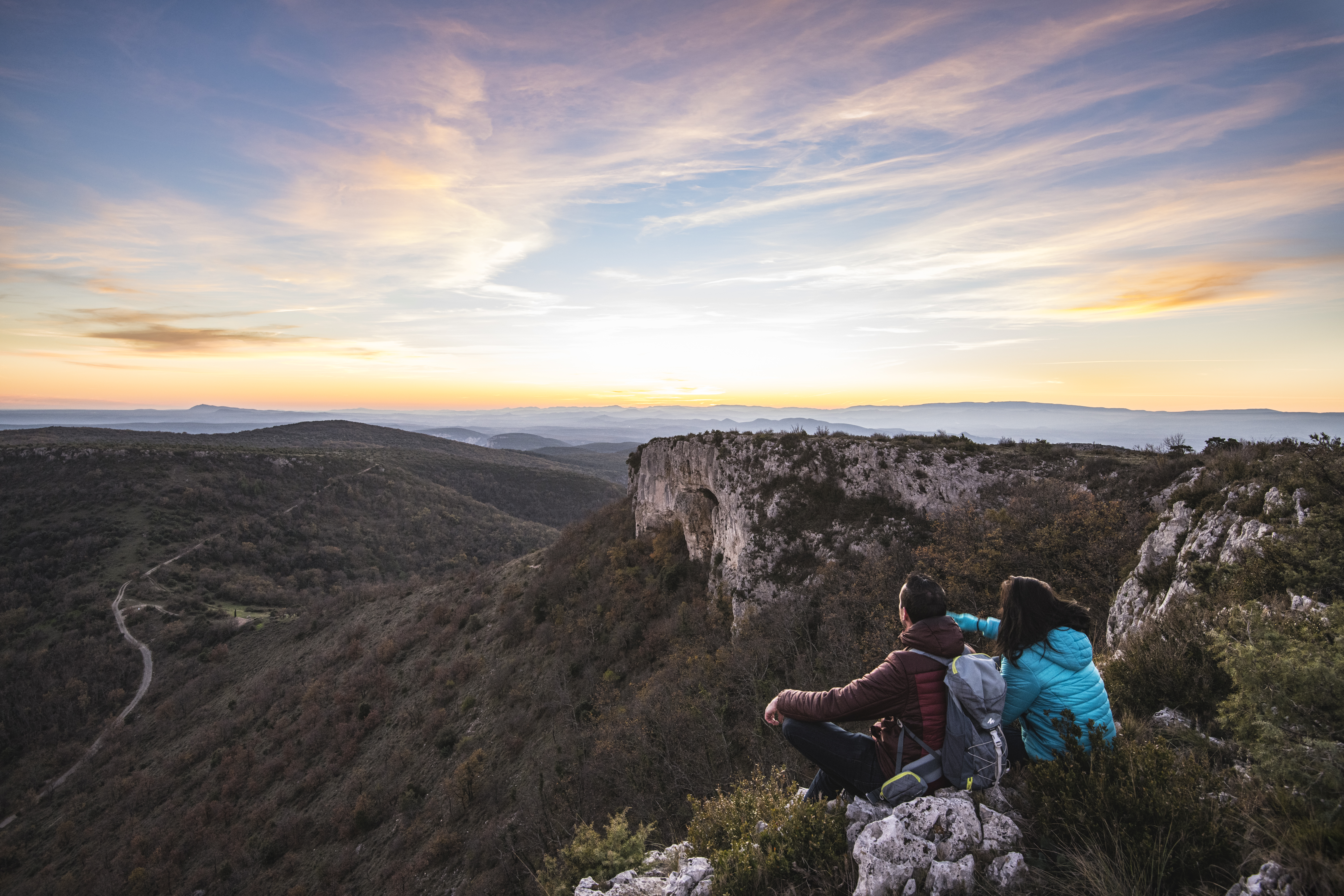
The Dent de Rez
This circular walk starts in the hamlet of Saint Vincent and takes you to La Dent de Rez, at 719 metres the highest point in southern Ardeche. It offers a magnificent 360° panorama of the surrounding reliefs such as the Cevennes, Mont Lozère, the Baronnies and Mont Ventoux. This Natura 2000 site is a haven for rare and protected bird species such as the vulture and the hawk eagle. The Dent de Rez is the highest point in southern Ardeche. It offers a unique panorama. It is located in a protected area and is home to rare birds.
Description
From the hiking information sign, head towards the red fire hydrant and take the Dent de Rez and Col d'Eyrole, clearly visible on the horizon, as your sights as you walk along the houses of the housing estate, following the wooden posts that mark the path.
Opposite the cemetery, turn right onto the road and immediately take the path along a wire fence.
- Continue until you reach the Bréchon junction. Cross a small tarmac road towards Gerles. Turn right onto the road in a residential area at La Rouvière, then right onto the small road to Les Reynouards, passing lavender fields and vineyards. Turn right and follow the signs to the nature reserve.
- Turn left onto the small tarmac road, which becomes a footpath at the first bend, and go over the barrier restricting access to authorised vehicles only. You are now entering the protected area.
- At the Col d'Eyrole, turn right towards the foot of the cliff. The closer you get to the cliff, the steeper it becomes.
- Cross a short escarpment in the rocks that gives access to the summit plateau.
- Follow the edge of the plateau to the right to reach its highest point, where you will find the orientation table. Continue across the moorland to the opposite end of the plateau. At the Dent de Rez signpost, turn right towards Gogne and follow the path down a few stony switchbacks to the Col de l'Aulagner.
- Continue straight ahead to reach the nearby hamlet of Gogne.
- Just after the first house, turn right onto the path that initially follows the ridge as far as the Serrélia junction.
- At this point, turn right and head downhill into a deep valley.
- Cross the stream over a stone bridge and climb back up the opposite slope along a small, more or less tarmac road. At the top of the climb, you come to the crossroads with the Chemin de Brechon. Turn left and walk along the housing estate in the opposite direction back to the school.
- Departure : Hamlet of Saint Vincent in Gras
- Arrival : Hamlet of Saint Vincent in Gras
- Towns crossed : GRAS and LAGORCE
Forecast
Altimetric profile
Recommandations
Around sectors 4 and 9, this route has some very steep sections, which can be impressive for people who are sensitive to vertigo.
WARNING! For your own safety, the safety of others and the protection of the natural environment, during periods of drought or extreme heat, to prevent fires from starting:
- do not smoke; if you do, place your cigarette ends in a pocket ashtray (an ember or a cigarette end that has not been properly extinguished can cause a fire several hours after being discarded);
- avoid anything that could act as a ‘magnifying glass’ on dry vegetation (glass, bottles, etc.);
- no campfires, barbecues, camping stoves, candles or oil lamps.
Access and parking
From Vallon-Pont-d'Arc or Bourg-Saint-Andéol, take the D4 to Saint-Remèze.
Then follow Gras on the D362 to the hamlet of Saint-Vincent.
Parking :
Report a problem or an error
If you have found an error on this page or if you have noticed any problems during your hike, please report them to us here: